
Location scouting for an upcoming photo shoot brought me to the north end if the Great Salt Lake. Pretty desolate looking and just what I had in mind. Have any of the blog followers travelled this route to the Lucin sun tunnels?
Location scouting for an upcoming photo shoot brought me to the north end if the Great Salt Lake. Pretty desolate looking and just what I had in mind. Have any of the blog followers travelled this route to the Lucin sun tunnels?
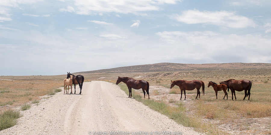
Working on the last post I remembered that I had another shot of a group of horses that I wanted to share on LATW. Taking the scenic route home from Jackson to Cache Valley via Diamondville last fall ended up taking many more hours than expected. With a lot ground to cover, dramatic sky, fall color and a photographer driving it was anything but quick. After a few stops you just have to stop stopping or it will be midnight before you are home.
Fall color near Bondurant, Wyoming.
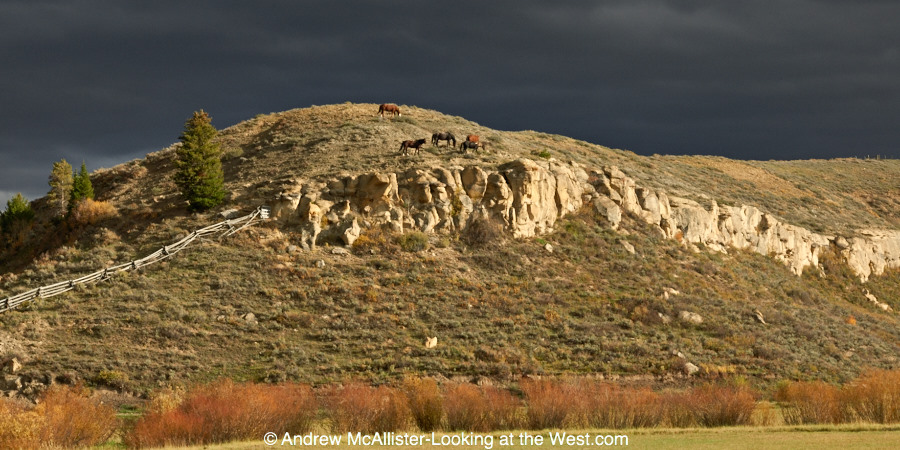
Horses south of Bondurant, Wyoming

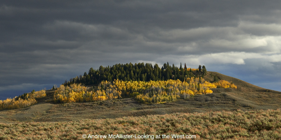
The Flat Top, north of La Barge, Wyoming.
Once, when heading out to see Robert Smithson’s Spiral Jetty we came upon this family of horses grazing near the road. The landscape of Promontory is austere and so different from the I-15 area just 40 minutes away. Locals will tell you that the road was much rougher in years past and had a few points where 4WD was required. In my many trips out there I have seen Audi Coups, passenger vans and even a Kenworth. Follow the signs and drive sensibly and you will make it.
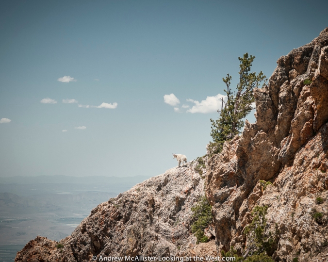
This was a year of looking, learning and contemplating. If I had to choose just one image to represent 2013 it would be this image of a mountain goat on Willard Peak in Northern Utah. I took the photo on a drive to Inspiration Point with a photographer friend who shoots pictures of wildlife. Unlike earlier trips when I looked at animals through binoculars, this time we hiked to the mountain goats and saw them at close range. I look forward to doing more of this in 2014. Technical info: Willard Peak via National Forest Road (starts in Mantua) to Inspiration Point. Accessible in warm months by automobiles with high clearance. The last few turns are at over 9000 feet elevation and exposed. Not for the faint of heart.
Lone teenager at Delicate Arch in Arches National Park. Any year when you get to visit Moab six times is a good year. The area offers so much to explore and so many photographic possibilities that it boggles the mind. Now that I can go there frequently, I have the luxury of not feeling rushed or compelled to fill the day with a million must-see things.
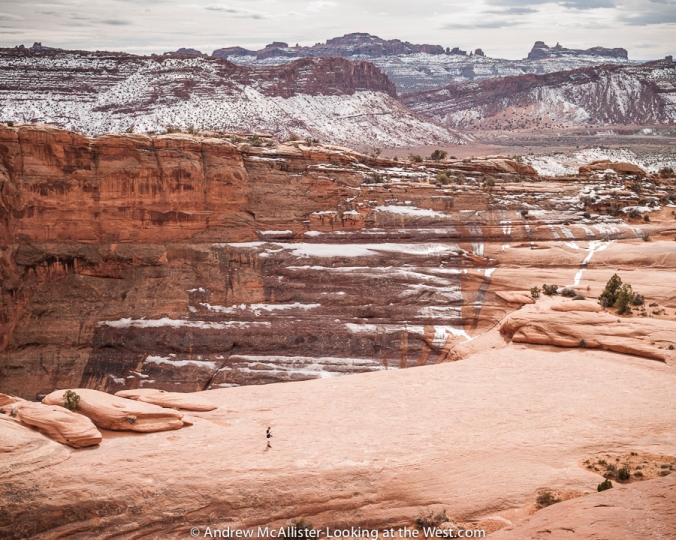
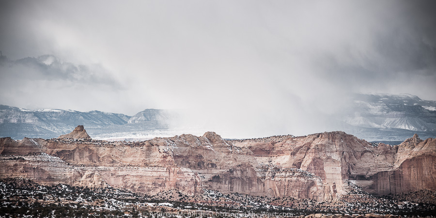
Ghost Rocks viewpoint looking toward the Hunter Power Plant. This photo was taken on a solo winter trip to photograph the area. It was nice to experience Southern Utah at a slower pace and find new locations like this. The quickest way from Moab to SLC is through Price, but a winter storm made travel over Soldier Summit questionable so I took I-70 across the San Rafael Swell and saw a new part of the state.
 Phone Home on the Range. Last spring I had the opportunity to travel the Kokopelli Trail on a Cruise Moab pre-run. A friend was writing a review of an off-road trailer so I came along to document the run. This great trip gave me access to some amazing country that is not accessible with my stock 4-wd vehicle and I got to meet a group of off-road travel enthusiasts. The view from here to the East Tavaputs Plateau–the ridge line in the distance–is more than 40 miles.
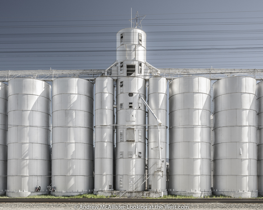
In 2012 I wrote about a grain elevator in Preston, Idaho that burned down and how it seemed to have changed the identity of the town. This year I explored this idea and created a series of images documenting grain silos in small towns within a few hours of Cache Valley, Utah. The image above is from Soda Springs, Idaho. More images from the series can be found on my website.
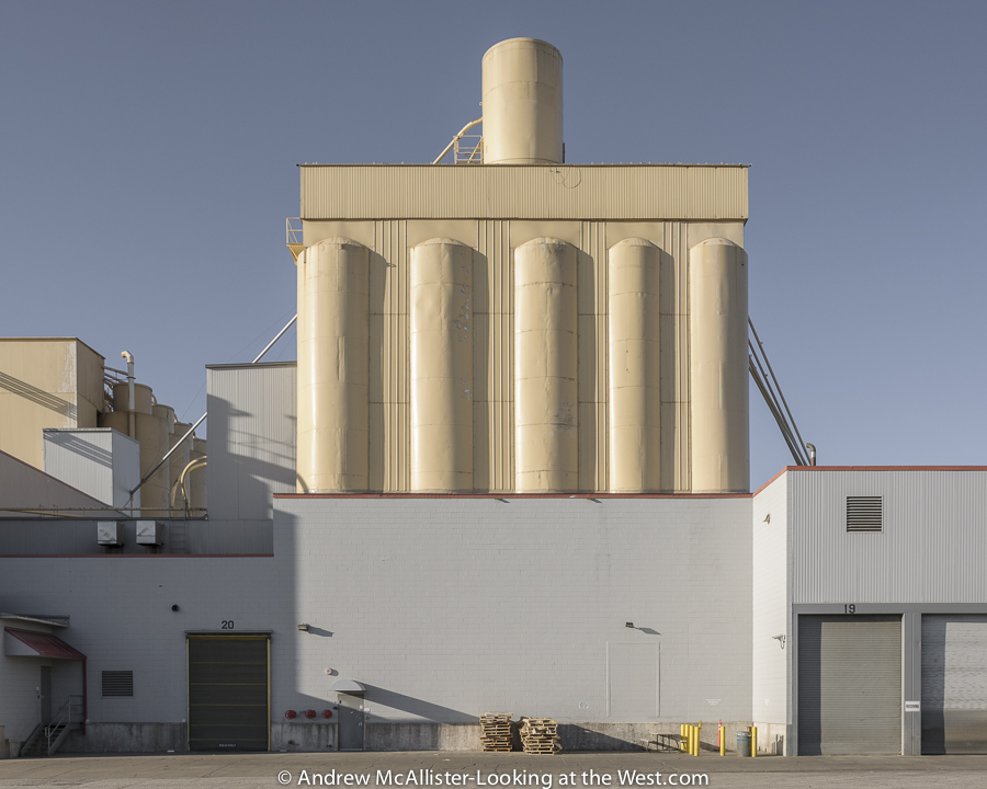 The series on grain elevators led me to industrial areas of towns and other sites like this at American Nutrition in Ogden, Utah. The dramatic light and shadow from the late afternoon sun bring out the structural beauty in this otherwise mundane industrial facility.
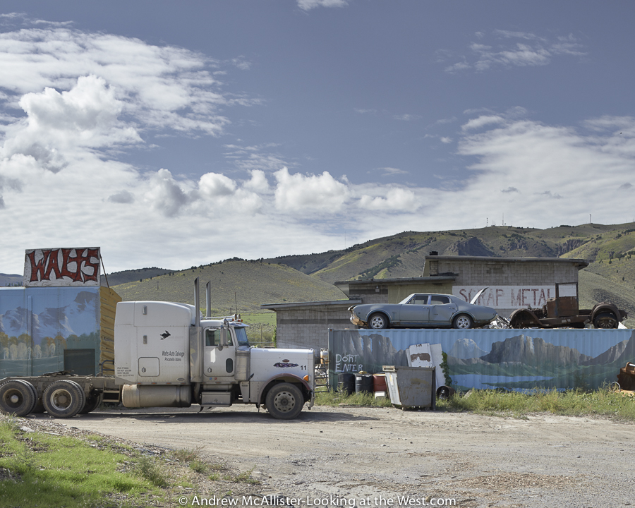
My search for silos took me north to Pocatello, Idaho, where I came across Walts Scrap Metal. It may not speak to everyone, but it interests me because of the play of the flat surfaces depicting western scenes against the actual western landscape. Additionally, the compression of space and the illusions it creates is a kind of puzzle and you have to really look at the photo to pull the different elements apart and try to make sense of the image. Scenes like this make the hours of driving worth it to me.
On a return trip to Utah from Denver I crossed the continental divide via Rocky Mountain National Park’s Trail Ridge Road. I had just completed a Phase One Capture One training event and was delighted to come upon this dramatic scene.
As I mentioned, 2013 involved a lot of learning and looking. When not photographing I spend a lot of time looking at the world via Google Earth. Last year I took advantage the opportunity to look down from an airplane window in Iceland: the location is somewhere between Reykjavik and Akureyri.Shelf road leading out of Spring Canyon. From my sixth and final Moab trip of 2013. I hope you enjoyed this short review of my 2013 photographs and if you have a similar post about your past year’s adventures please share a link in the comments section.
Happy travels and pleasant photography for the coming year!
On your way to the Needles District of Canyonlands National Park in Southern Utah on the top of the first hill you will pass by a small ghost town with a locked gate and a sign over the entrance that says Maries Place. Most people will hardly notice and just pass by this desolate and nondescript grouping of buildings without ever knowing the colorful story of what happened here. Above: the Inner Portal of the Home of Truth. The story of these buildings can be found in the wikipedia entry “Home of Truth, Utah”. 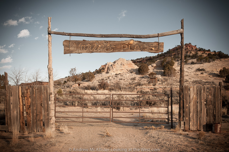 Above: The locked gate. Respect private property and photograph the Home of Truth from the road. Hopefully in the future it will be open for visitors to explore.
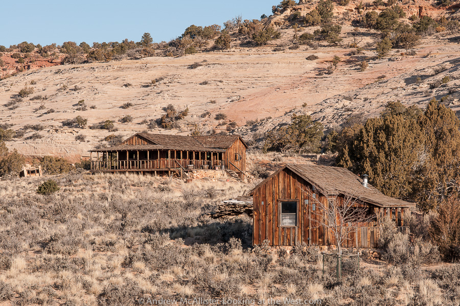
Above: Abandoned buildings at the Home of Truth. I would love to someday tour the facility and see the view from that wrap around porch.
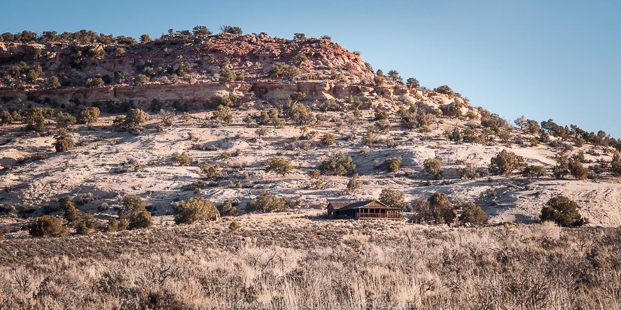 Above: The largest building at the Home of Truth photographed in early morning light from North Flats Road. The area around the Home of Truth is great for scenic driving with many striped rock outcroppings and the occasional corral.The better part of an hour south of Moab it is usually passed by as visitors are on the way to the famous newspaper rock petroglyph site.
 Locations like Delicate Arch are difficult to photograph. Look online and you can see thousands on technically great shots, thousands more that try to hard with star trails, sparklers, dramatic light and on and on. Lots of advice as to best time of day or examples of the arch in different seasons. The first time I was there I made a midday panorama that had around 70 people in it. A cold day in early March had a dozen people up there posing for family photos under the arch and more on the way up. Delicate Arch is kind of like the Eiffel Tower in that the thing itself is so cool and so recognizable that photographs of it rarely do it justice. Delicate Arch and they way you come up on it from the trail is so powerful that I like to sit down and enjoy the view and spend some quality time taking it all in, consider how amazing it is that this exists. Then take some pictures, mostly for my personal archive.
 As I was sitting up there on a rock at Delicate Arch, camera anchored to one of my trusty tripods, watching all the people and taking it in. A family with teenage boys approached the Arch and had a little photo session. Mom and Dad hugging under the Arch, Mom with the boys, goofy shots looking like you are pushing the arch, all the usual stuff. One of the teenage boys wandered away from the group and was messing with a phone or iPod. As I watched him I noticed that this was the picture that I wanted to make. Kind of funny to walk up to a world famous site and take a picture that does not include the “famous” thing. It’s a shot, a view, a situation that I had not seen, it spoke to me of being disconnected to the environment.
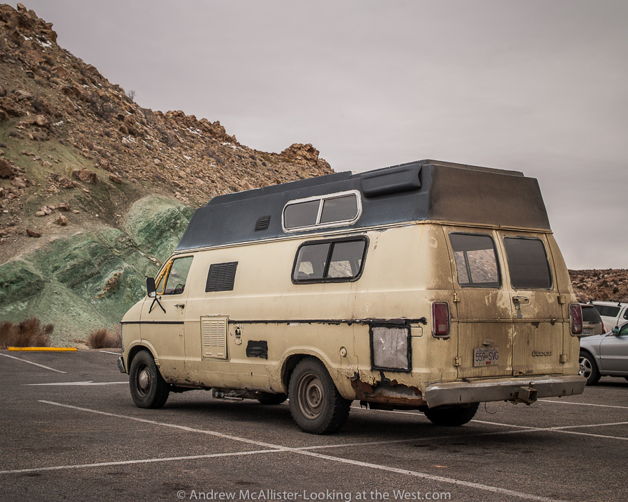
People watching in the National Parks is a great activity as is spotting cool cars in the parking lots. As we concluded the hike and made it to the parking lot the first thing I noticed was this really cool bright red Jeep. Chrome wheels, big tires, winch, fancy bumpers, the works. Easily a $50K ride but with no soul (at least not yet). Parked a short distance was this old Dodge Van. My friends and I gathered around it and inspected it’s scars, rust and dirt. This was not the best ride in the lot but man it has some history. Just looking at it you know it has had some serious adventures.
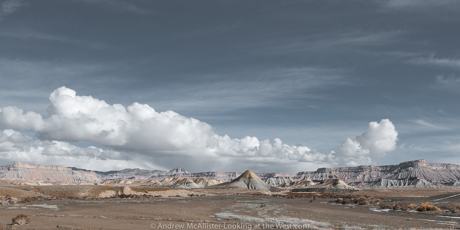
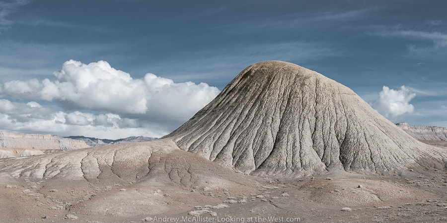 Not all of Southern Utah is Red Rock. The ranch exit of Floy (near Crescent Junction) has a great collection of strange grey lumps that may make you think you are on another planet. I last visited in early February and it was much to muddy to go exploring off the road. The time before it was around 100˚ with no shade. This landscape at the base of the Book Cliff does not fail to inspire.
Above: When driving Utah 152 watch your speed. Because the road is empty 99.99% time, it’s tempting to drive in the middle or left side of the road to avoid potholes and rough section. Beware though that the road does have blind areas and would be terrible to have a head on collision in such a remote place (or anywhere). On a technical note these images were shot using Nikon’s 24mm PC-E lens. I’m finding it to be a great lens for the landscapes I’m photographing. Any thoughts on the lens flair in the right corner. Some people like it, I usually get rid of it.
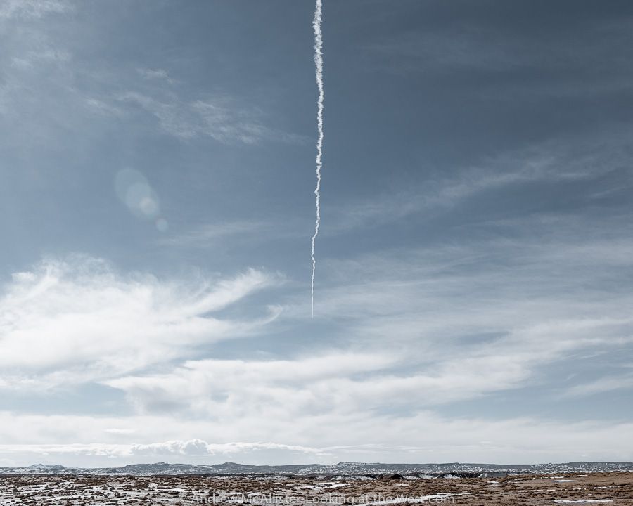 Above: Contrail in the Southern Utah sky.
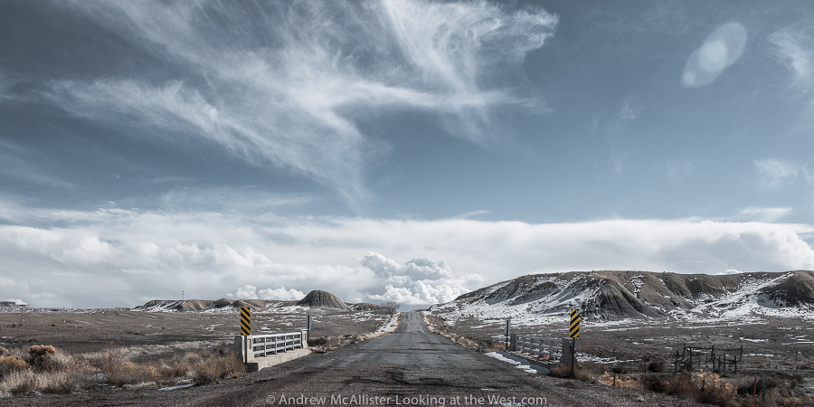
 Above: Open Road at the Floy ranch exit near Crescent Junction. Note the lack of shoulder and no fence so watch out for the wildlife.

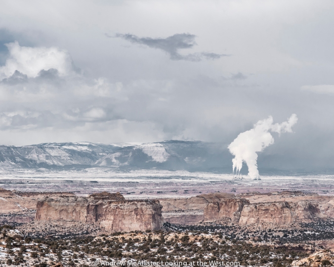
Above: Huntington Power Plant from Ghost Rocks Viewpoint along I-70 in Southern Utah.
Updated (3/16/13) from Wikipedia “The highway then ascends Ghost Rock Summit, the highest point for I-70 inside the swell. At the summit is another view area overlooking the Little Grand Canyon of the San Rafael River.The summit is named for unusual rock formations nearby. The Ghost Rocks themselves are at 7,405 feet (2,257 m), although the freeway is slightly lower.” Read the whole article on building I-70 through Utah here.
Above: Cloudburst above Castle Valley Utah.
 Above: I-70 road cut at the San Rafael Reef in Southern Utah. To avoid a snow storm on Soldier Summit I decided to take I-70 for my return route from Moab last month. What a good decision it was. The San Rafael Reef is visible from my usual route (Utah 191 from Price) but I had never been this close. If you are traveling I-70 through this area plan extra time to stop at all of the scenic overlooks, they are well worth it. Taking this route greatly expanded my desire to explore Southern Utah. Expect more information and photos from this amazing part of the state.
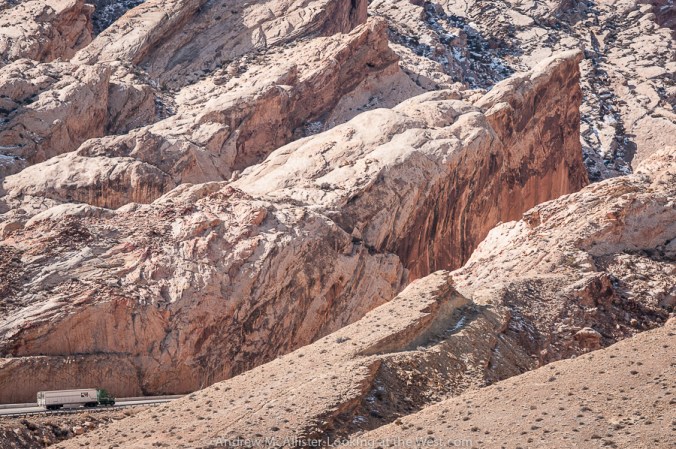 Above: Detail of the road cut at the San Rafael Reef. Didactics at the rest area explain the massive project to widen a slot canyon into the modern highway we travel today.

Above: I-70 Rest Area at the base of the San Rafael Reef. Photographers would be crazy not to stop.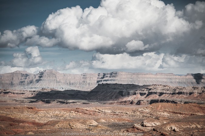
Above: Looking toward the Book Cliffs from the San Rafael Reef.
How many of you have been to this part of Southern Utah?
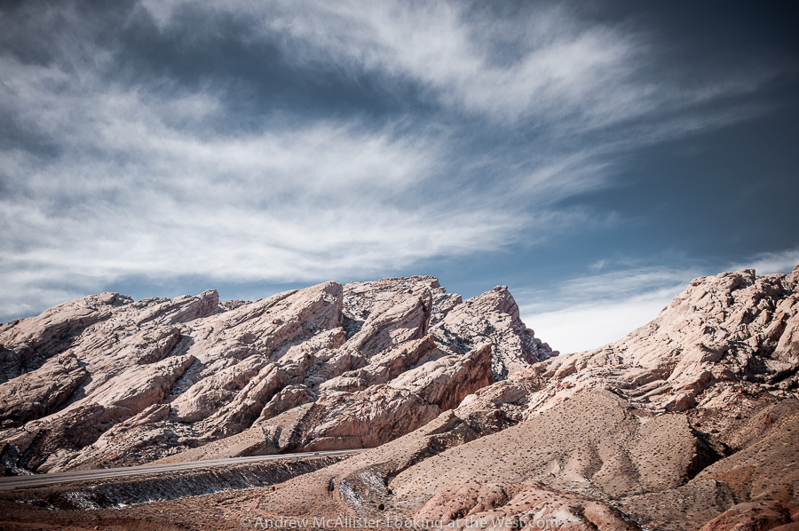
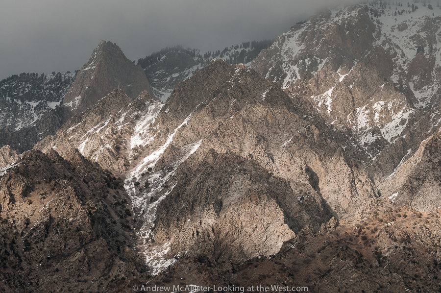 Above: Dramatic Light and shadow on the base of Willard Peak in Northern Utah. Recently I have expanded my lens set to cover wider and narrower views and so begins the process of learning how these tools effect how I see and how to get the most out of them. The above image form this past weekend was made with the wonderful Zeiss 100 Makro-Planar. I am pleased with the lenses ability at and near infinity, a distance that many of my subjects occupy. Excellent contrast and focus from 1.4 miles distance in the foreground and at 2.23 miles near the top.

Above: Dramatic light and shadow on the rugged base of Willard Peak in Northern Utah. Above: Dramatic light and shadow with blue-grey sky and passing cloud cover on the rugged rocky base of Willard Peak in Northern Utah.
