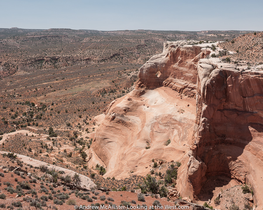
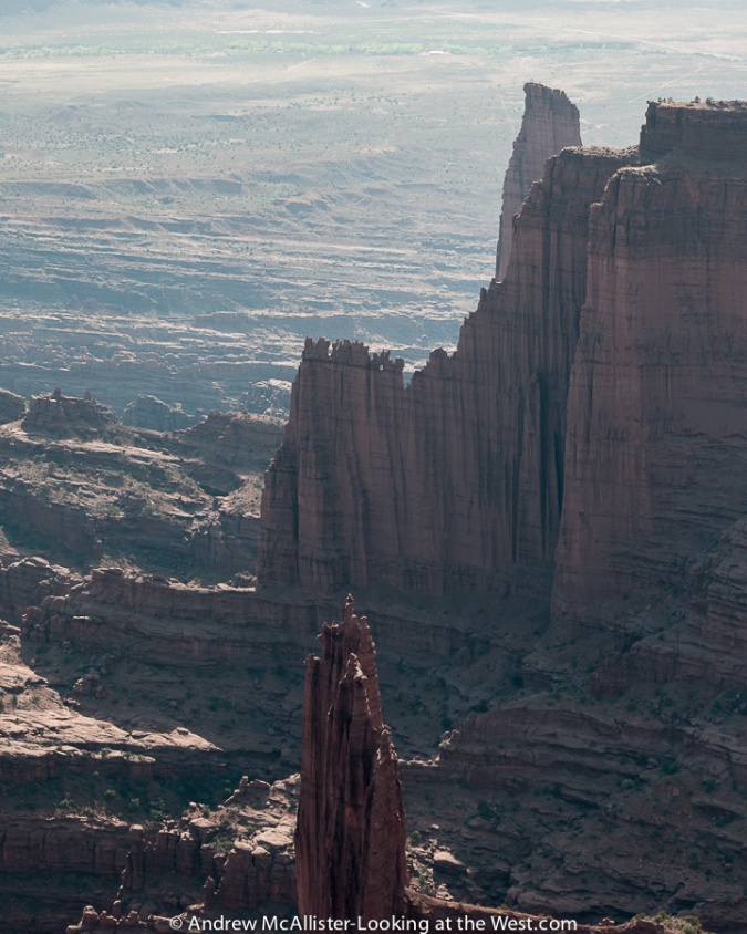
Day two of the Kokopelli Trail the most photogenic of the trip. We crossed increasingly scenic landscape starting with the austere Cisco Wash followed by the increasingly rugged Owl Draw and Dome Plateau (pictured Below). The day concluded with the Top of the World trail that terminates at a rock ledge hundreds of feet above the valley floor. The view from the Top of the World trail terminus one can see Onion Creek and Fisher Towers below you, Professor Valley and the Colorado River in the distance and the ridge line of the windows section of Arches National Park some 15 miles away.
Cisco Wash
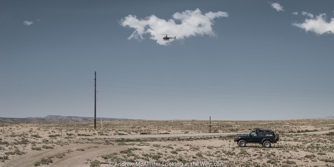
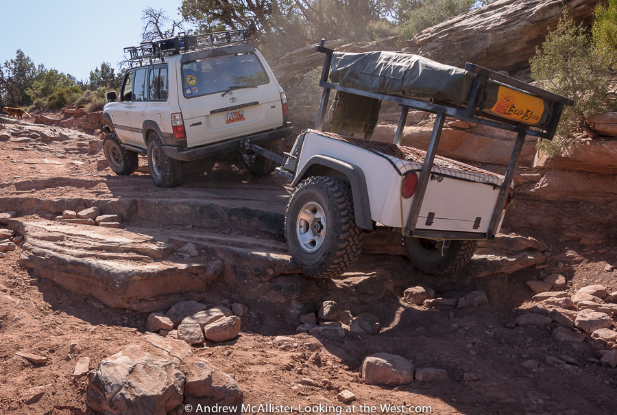
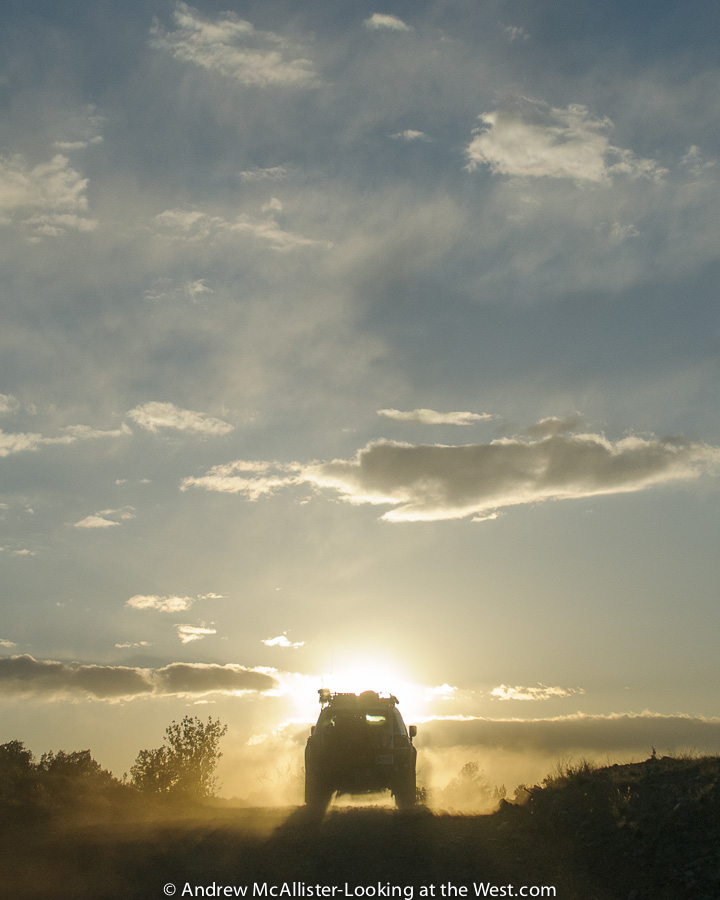
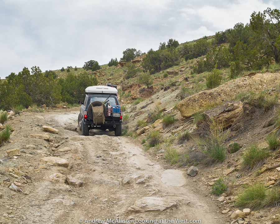
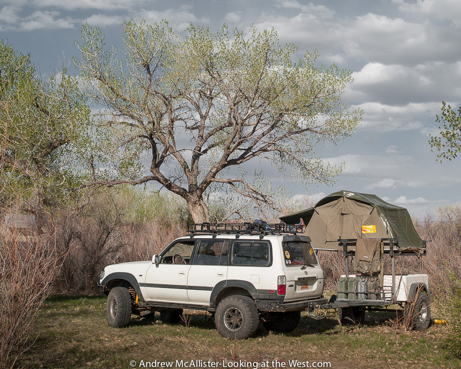
After a hearty breakfast our group broke camp and headed for the trail for a long day in the saddle that would cross increasingly scenic territory. The first section took us from our camp at Fish Ford over to Utah 128 via a dusty two track that crosses Cisco Wash. Seeing the depth and departure angle of the wash I jumped out to get the shot above for Sean’s trailer review. Being in a wash like this one, I can understand why maps have warnings about roads being impassable when wet. This last section of this trail was pretty dusty and our groups vehicles spaced out for safe driving. Below a member of our group waits for the last vehicle as we turn onto Utah Scenic 128 and head toward Owl Draw. The helicopter was just flying by.
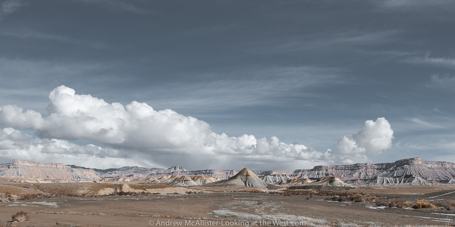
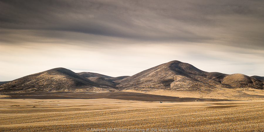
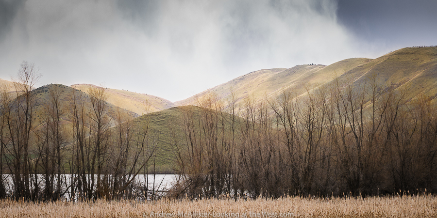
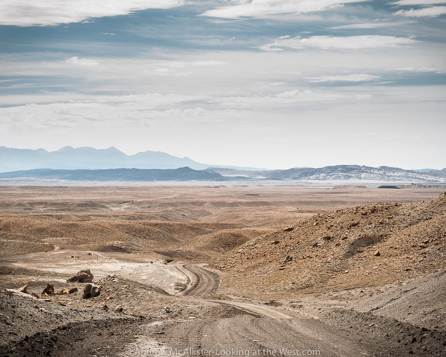
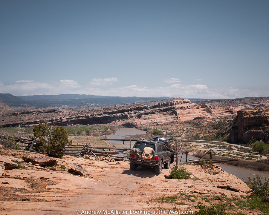
Owl Draw and Dome Plateau
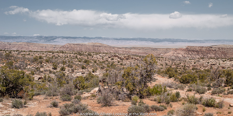
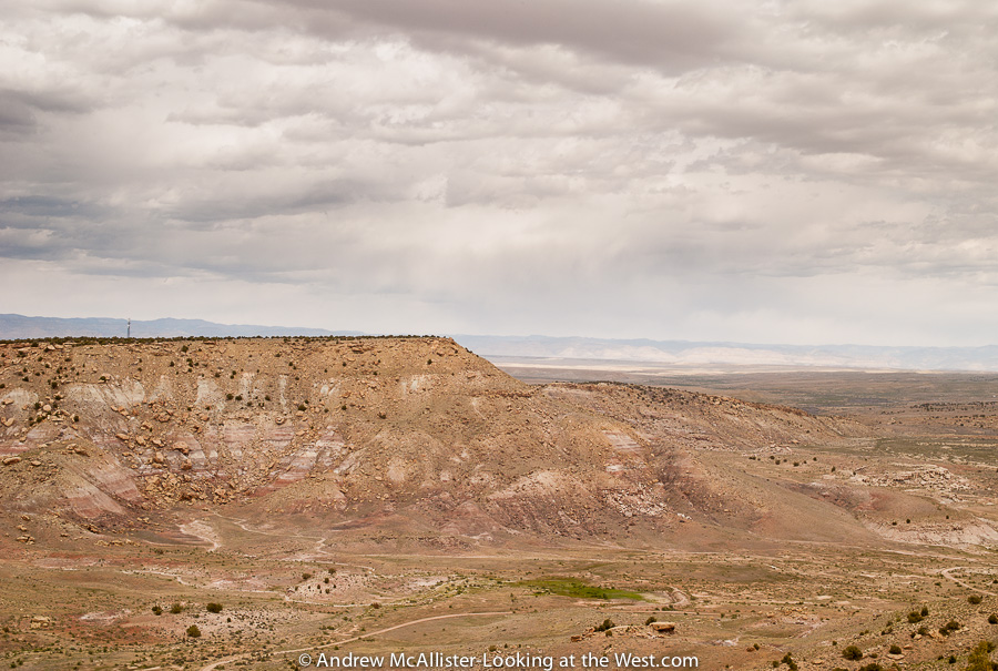
Utah Scenic Route 128 connects I-70 and 191 and follows the Colorado River through Professor Valley and well worth the trip. Owl Draw is a 4×4 road that starts near Gordon Ranch just as 128 closes in on the Colorado River. Above is looking North towards the East Tavaputs Plateau.
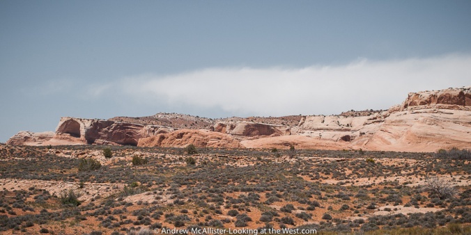
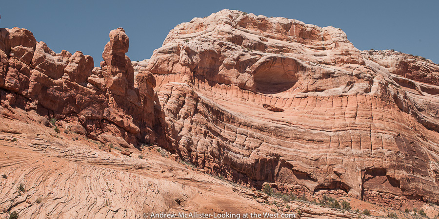
After some time we made a quick stop at a scenic overlook to stretch the legs and grab a photo and we were off again. Interesting to see how the wind is sculpting these sandstone cliffs and the effects of water drainage on the soil.

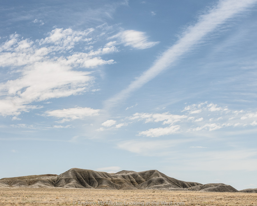
Above: Yellow Jacket Canyon
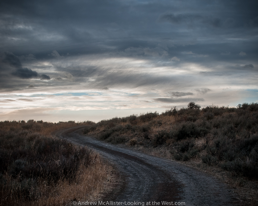
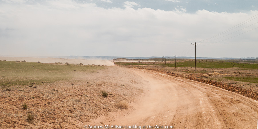
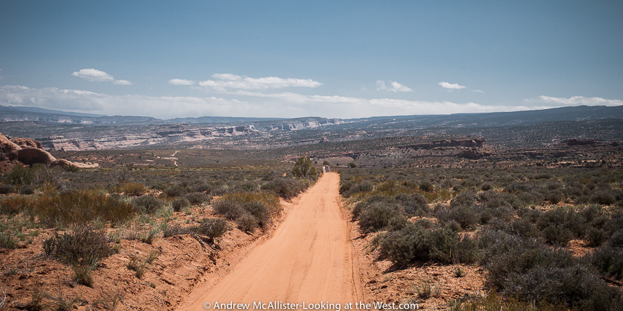 We welcomed the long sandy stretches of road and breathtaking views as we headed toward the river crossing at Dewey.
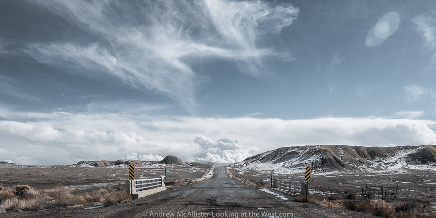
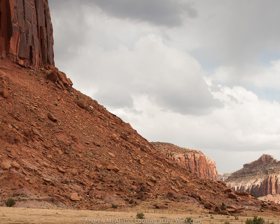
Close to the trails end our group passed through a gate with a nice view of the Colorado River and the crossing at Dewey. There are two bridges at Dewey. The original wood plank bridge burned in 2008 and there is a local effort to restore it. Our group would meet up at the old bridge foundation and then head to our campsite near the Delores River where we would have lunch and drop trailers before heading to the Top of the World trail. Note the tilted angle of the earth’s crust. Below: sandstone cliffs and domes near Utah Scenic 128.
 Top Of The World Trail
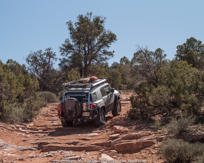

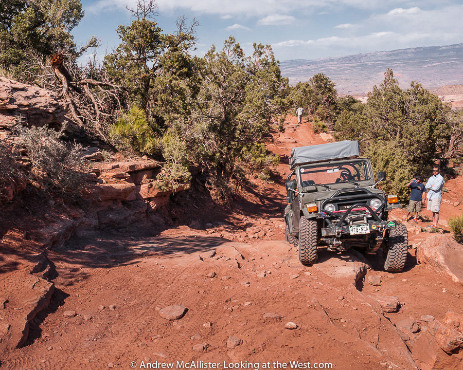
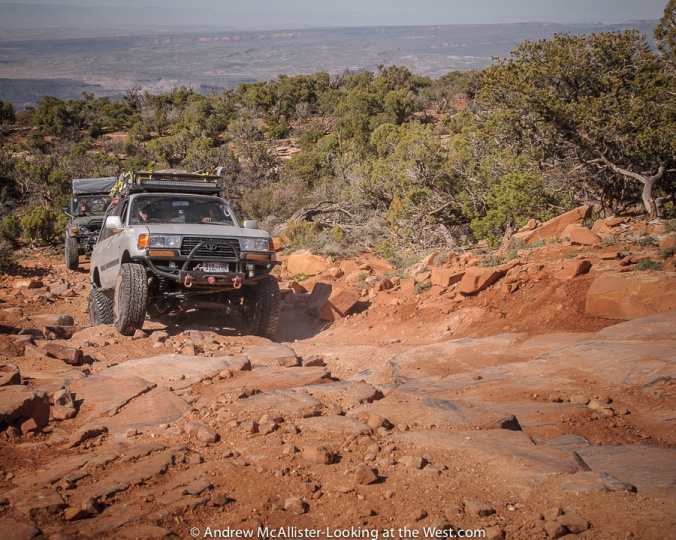
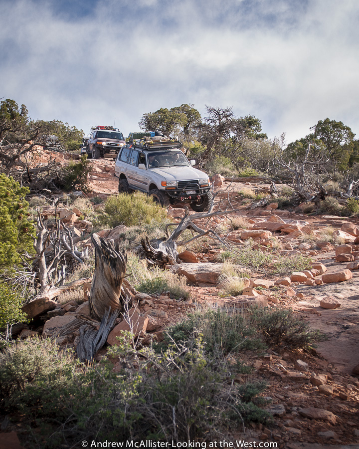
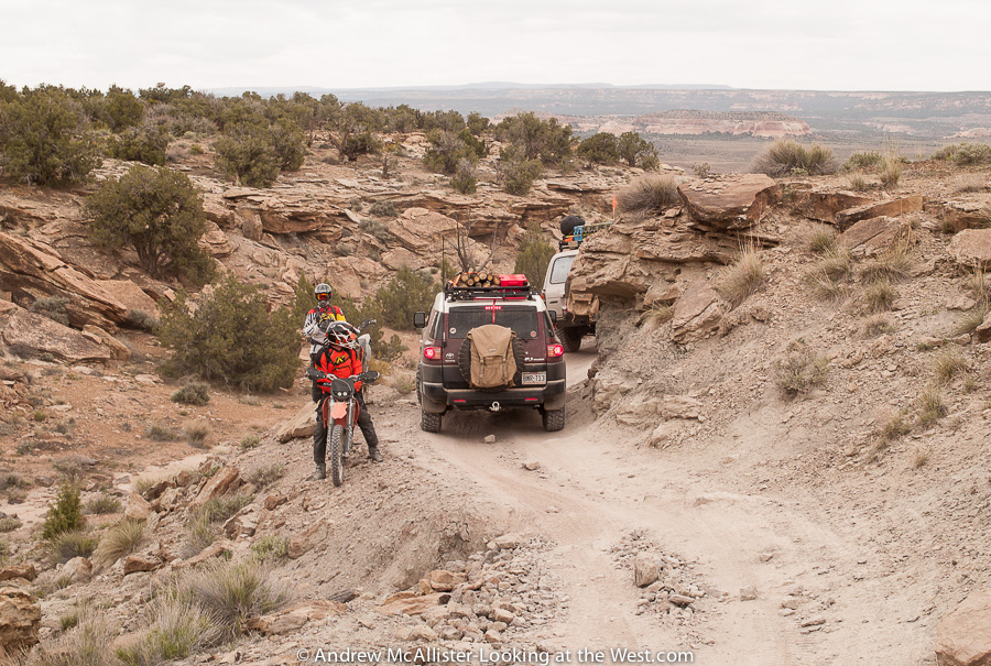
Ace from the Book Cliffs Cruisers leads the charge as we start the Top of the World Trail. Guide books state that this trail takes about 3 to 4 hours to complete and we were starting after lunch so we had to make good time when we could if we were to make it back to camp before dark. The first five miles were graded dirt road and have plenty to stop and look at if you get an early start. The picture above shows the start of the trail. The rock steps above would eventually turn into proper ledges as seen below at the first obstacle point. The Fun-treks guide book mentioned that this trail has gotten more difficult and once was doable in an aggressive stock vehicle. This would be my first time on a “Difficult” rated trail.
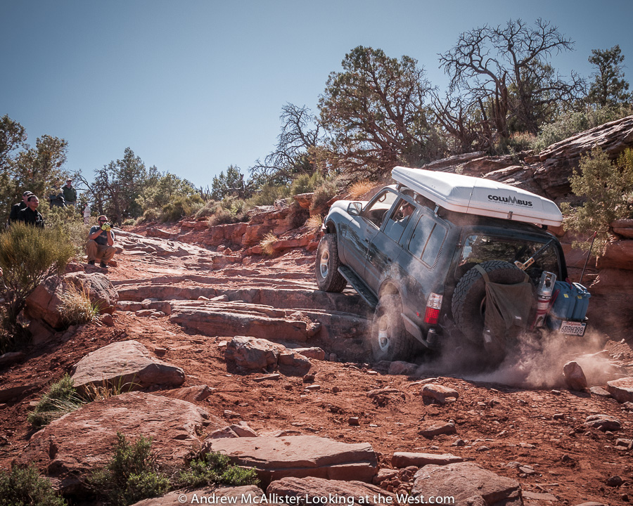
Above: Drivers assess the first major obstacle and plan a route. Below: With a good line and all lockers engaged Sean’s 80 series Landcruiser clears the ledge and pulls a trailer up it too. Since he was writing a review on the build and trail handling he opted to bring it while the others left their trailers at the campsite.
Below: Richard takes a line more suited for the FJ-40’s shorter wheelbase and clearance.
Below: Darius looses traction on his first attempt but soon clears the ledge.
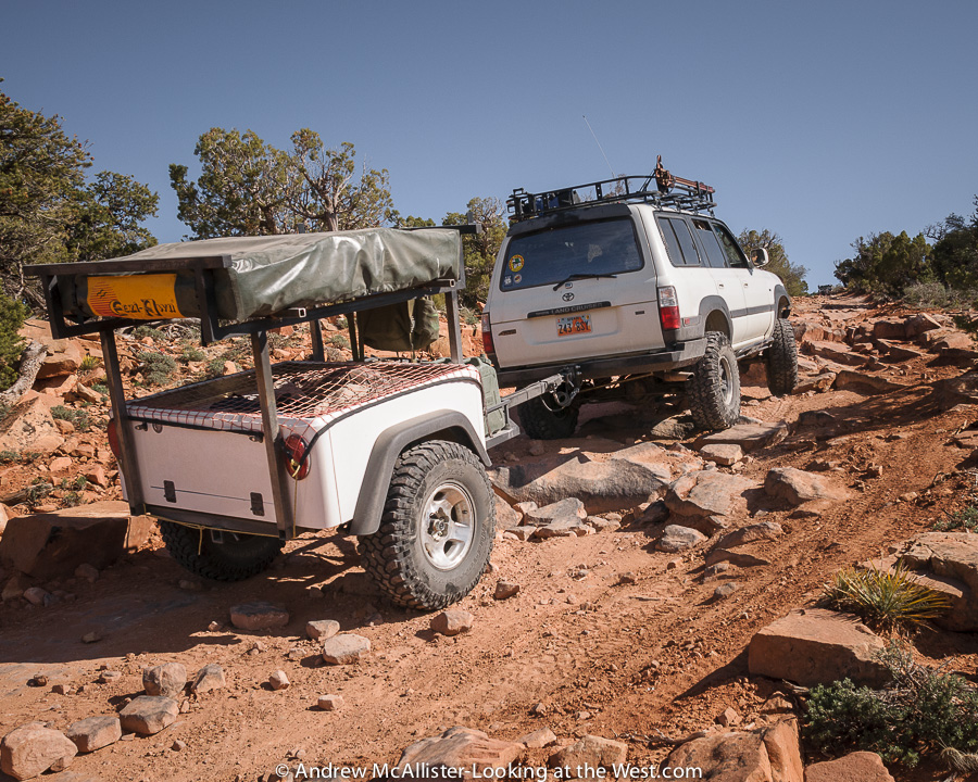
Below: Rocky sections test a vehicles articulation and the drivers ability to choose a line that considers the trailer as well as the tow vehicle. Passengers need to hold on… or get out and take pictures.
Below: In the far distance is where we started from this morning. On this trail you do feel like you are going to the top of the world.
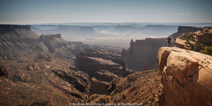
 Top of the World – The view
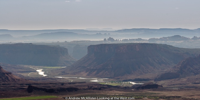

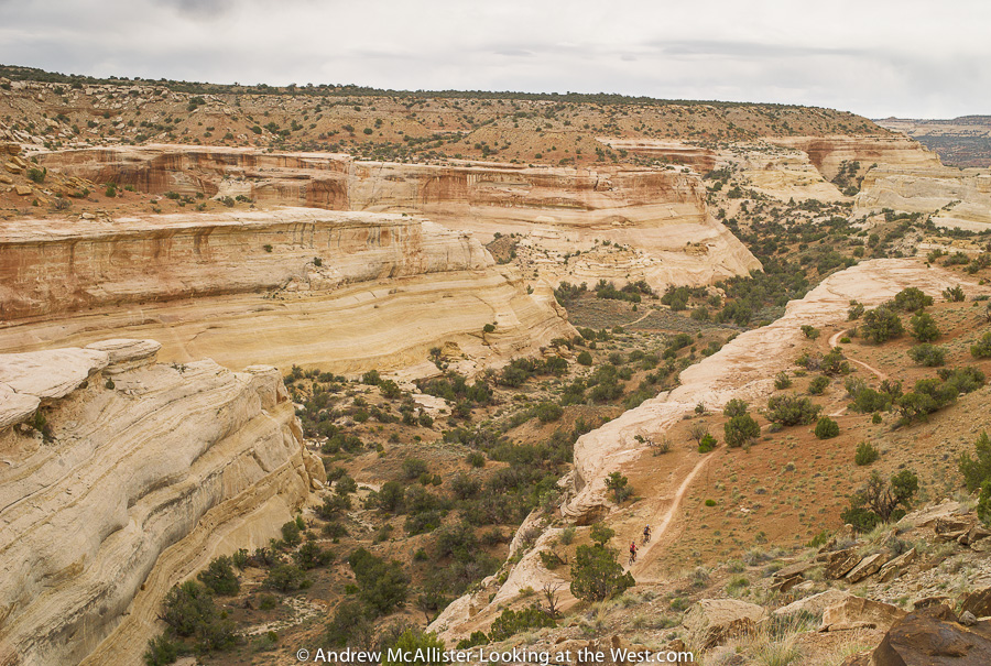
The view from the top was nothing short of spectacular. When we arrived every one grabbed whatever camera they had and started snapping away. Being late afternoon the sun was harsh and hazy and I have had to spend some time in Adobe Lightroom to get the images to the state you see here. Above you can clearly see the windows section of Arches National Park. This is a great location that I’d love to photograph in first light.
Above: Looking down on the backlit Fisher Towers and Onion Creek area of Professor Valley. Amazing view!
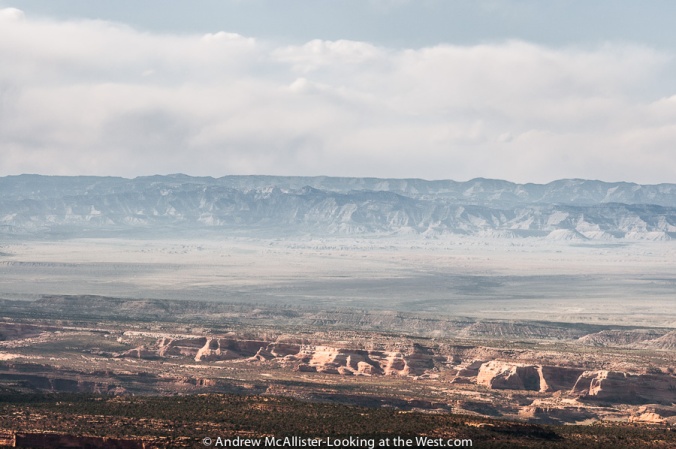
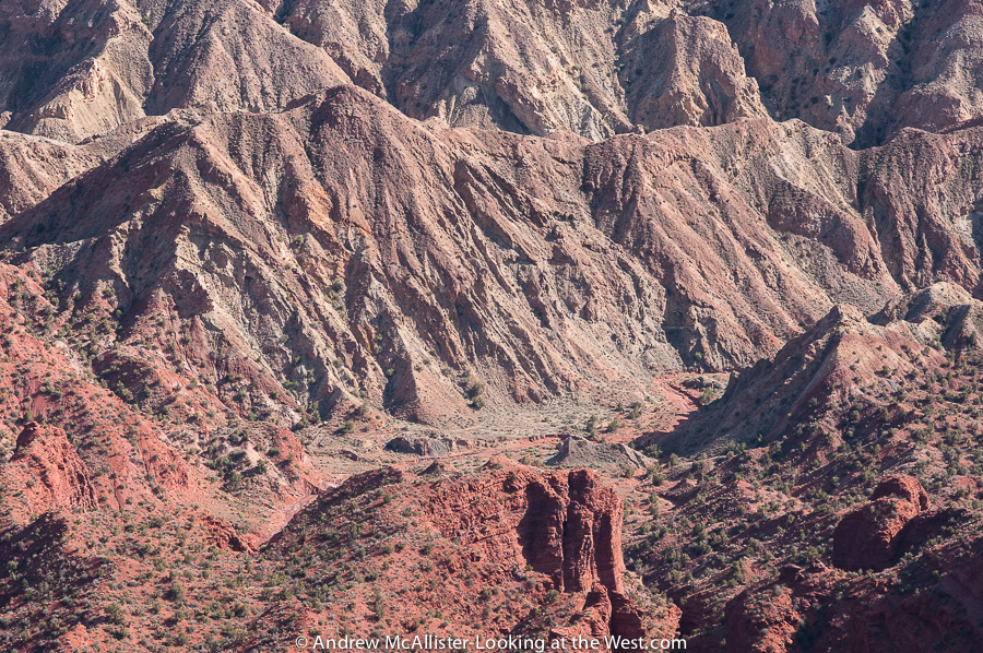
Above: Looking North West toward The East Tavaputs Plateau. The haze and fact that I was using a longer focal length lens made this a hard shot to resolve but the view of over 30 miles was worth the effort. The sandstone cliffs in the mid ground are where we were a few hours earlier. I-70 is visible just below the center on the left side.
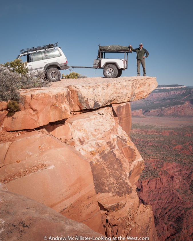
The overhang at Top of the World is a great photo op. Google it and you find tons of shots just like this. Sean however was not aware of the over hang and was surprised when he saw the picture.
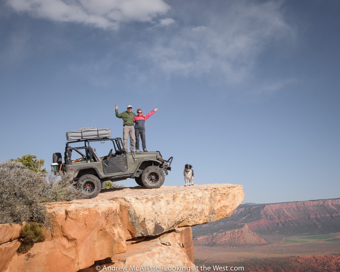
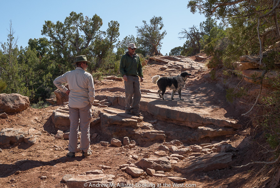
Above: Richard and Kim on top of the FJ-40, on Top of the World with dog co-pilot Shamrock.
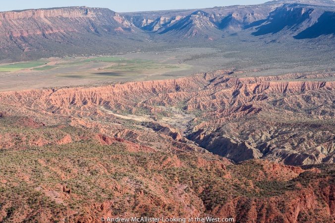
Above: Should you look down you will see Onion Creek and to the East: Fisher Valley pictured below.
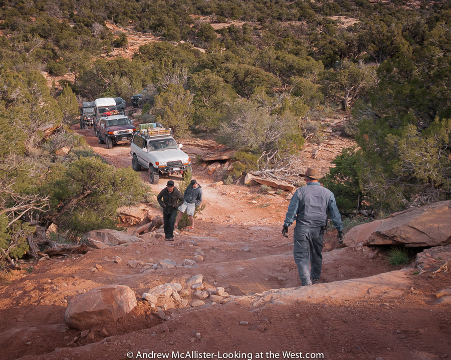
Below: After the photo ops we needed to get going as we still had a difficult trail between us and camp. A few people received phone calls at the top but cell reception would fade fast as we started back down the trail.
 Top of the world Trail – Return trip

Ace again leads the way. With the sun getting lower on the horizon and progress to be made I had to make the most of shooting from the Landcruiser. The shot above is through the windshield and below at a turn in the trail. Not bad if I do say so myself.
After a brief section of trail we came to a series of ledges that would challenge the Landcruisers with longer wheelbases. The ledges were covered with sand and spaced so that both front and rear wheels would be climbing up at the same time.
Below: A tight section of trail forced me to use the widest lens I had available to illustrate the spacing of the ledges. After this shot I switched to the other side of the trail and a safer position.

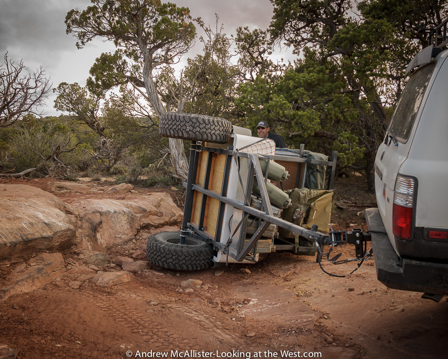
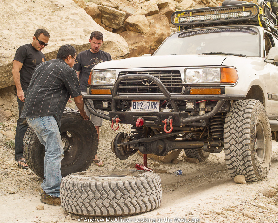
Below: Driver error caused our trailer to flip when stepping off this ledge. It was quickly righted with a couple of extra hands. As you can see the ledge has a high side and the trailer is top heavy with the tent configured the way it is. Sean writes about this incident in his review.
As soon as the trailer was ready to go our group progressed and we were on the main graded road before dark. Below: Joe steps his Landcruiser down one of the many ledges on the return from Top of the World.

Long day in the saddle was the correct way to put it. It was twilight when we got to camp. Everyone hustled to get tents setup before it was completely dark and with no dedicated camp chef tonight we would be on our own for dinner. After dark we gathered around the campfire and recalled the days events and planned for tomorrows adventure on Rose Garden Hill. After an hour or so I decided to call it day and head to bed. The days trek was pretty intense and I was ready for some sleep. Hopefully the winds would not keep me awake tonight as they did the night before.


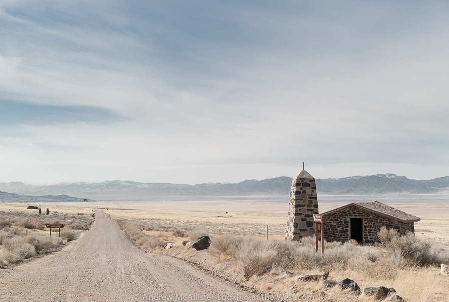
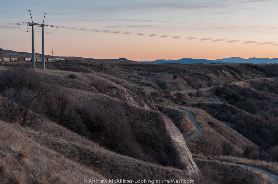
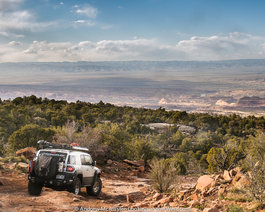
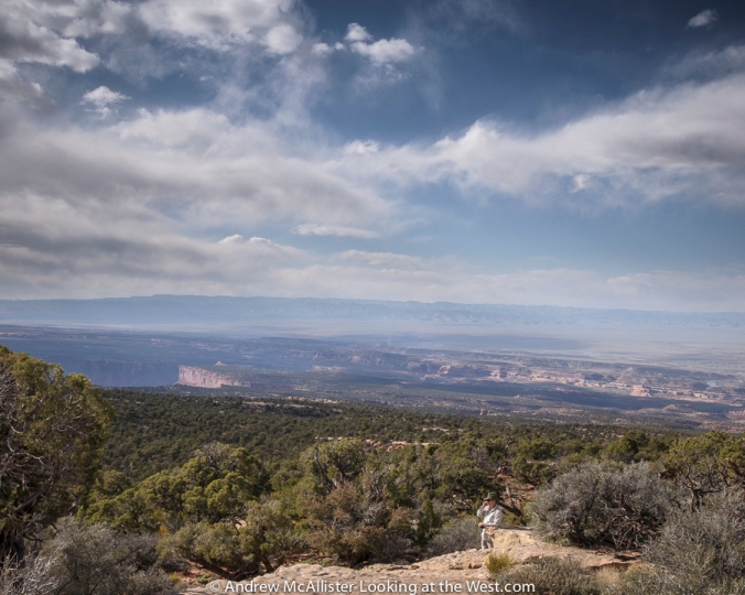 Phone Home on the Range. Last spring I had the opportunity to travel the Kokopelli Trail on a Cruise Moab pre-run. A friend was writing a review of an off-road trailer so I came along to document the run. This great trip gave me access to some amazing country that is not accessible with my stock 4-wd vehicle and I got to meet a group of off-road travel enthusiasts. The view from here to the East Tavaputs Plateau–the ridge line in the distance–is more than 40 miles.