Top images from 2012

Top images from 2012 and a little info behind their selection.20120102_Whites Valley Utah_020
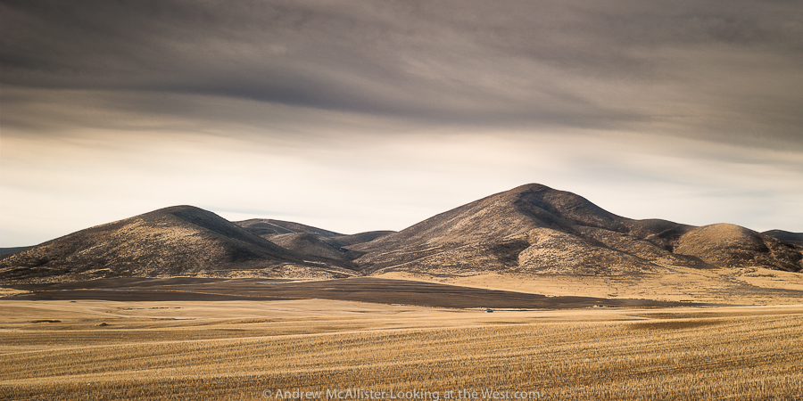
Above: Whites Valley in Northern Utah. An introduction to a different western landscape and the beginning of my exploration Northern Utah and Idaho. Looking forward to exploring the gem state in 2013 and have 4 trips planned already.

Simpson Springs Station.

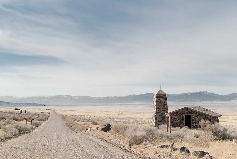
Above: Simpson Springs Station on the Pony Express Trail in the West Desert of Utah, from a journey I’ll do again this year with the UXOC. This is a beautiful and remote area that I’d love to explore more, maybe pulling a camper from Moby 1.Preston Grain Silo

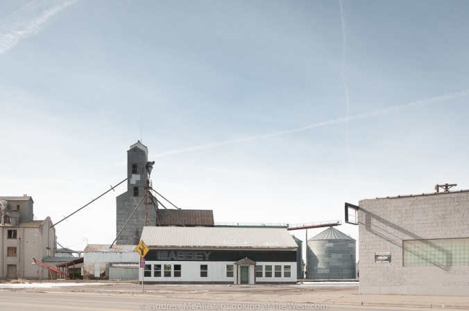
Above: Preston, Idaho on a sunny Sunday morning January 2012 and the start of a project looking at small western towns and structures that define place. In this case it was the grain elevator that defined entering Preston and unfortunately it was destroyed by fire a month later.Downey Idaho

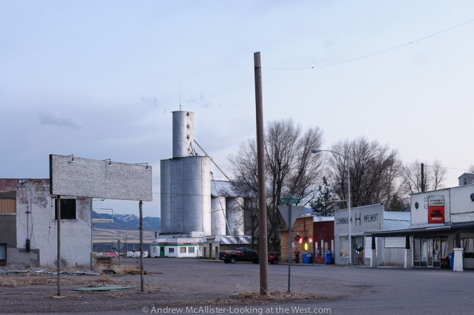
Above: Weston, Idaho and another grain elevator. This one looks particularly church like. I revisited Weston in December and the sign and pole have been removed. Time moves on even in small towns.20120413_Mantua_027

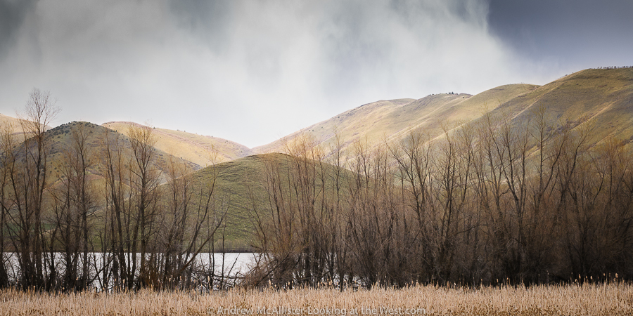
Above: Mantua, Utah spring 2012. At the time I took this the space reminded me of Iceland. Looking at it now it is nothing like Iceland, trees for starters. Maybe it was the really green treeless hills and the rain snow mix of weather. I’ll settle for exotic looking and not what you expect for a Utah landscape. FWIW locals pronounce Mantua as “Man Away”.

Road along the Bear River

Above: Near Cutler Reservoir early spring 2012. Jetsons-looking power pole in a barren landscape carved by man for irrigation.Beef Basin

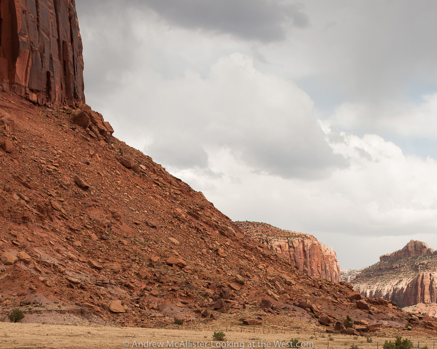
Above: Near the Needles District of Canyonlands National Park. Trying to get a feel for how massive these formations are (look at the fence at the base).20120805_Floy_Utah_008

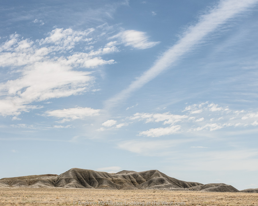
Above: Ranch Exit at Floy, Utah. Grey lumps in the barren landscape just north of I-70. Composed in a way that excludes the book cliffs and any of the red rock that southern Utah is famous for. People have commented on the texture of the grey earth looking elephant like.Driving the desert of Southern Utah

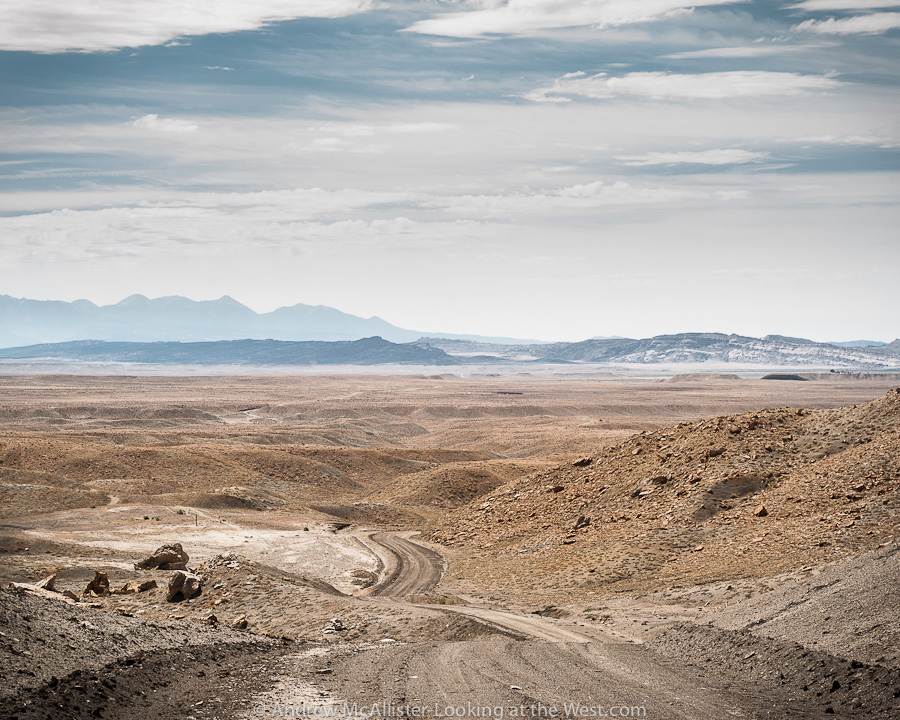
Above: from the base of the Book Cliffs looking toward Moab, Klondike Bluff and the Manti La Sal Mountains. From a solo trip to Moab in early August 2012.20120804_Onion Creek Road_048

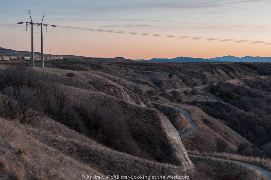
Above: Onion Creek Road near Moab. Look for more images from this area in the coming year. Lots to explore and photograph. This was taken on my first trip on the road and as it was getting dark I made my way back to the main road. Not being familiar with the road, alone, and without additional illumination on the Xterra. Why risk driving off the road in the dark? 20121021_Caribou National Forest_039
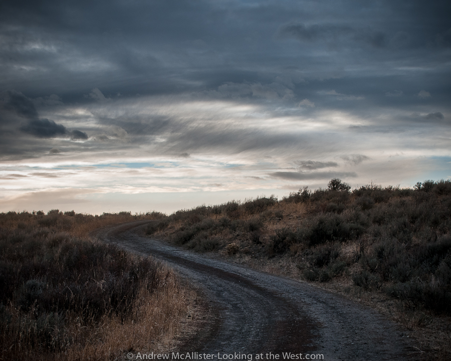
Above: Open road on Skyline Drive near Weston Canyon in Caribou National Forest. From a day of photographing open roads near the Utah-Idaho border in late October and my last trip on this road before it was closed for the season. As I was taking these images I came across three moose; a nice way to end a day of solitary photography. Work kept me busy the rest of the year and so this is where my 2012 season of photography ended. Looking forward to what 2013 will bring.

Thanks to everyone who liked a post, made a comment, nominated me for an award or became a follower of Looking at the West.

Southern Utah is not all red rock

Driving the desert of Southern UtahAbove: Thompson Pass looking toward Moab. If you look close you can see Crescent Junction and State Highway 191. This is from the base of the Book Cliffs looking South. The road is a nice little side trip if barren landscape, boulders and the occasional Antelope is your thing (it’s mine). I read that somewhere along the Book Cliffs a Tar Sand extraction operation is starting up. Mixed feeling on that. Anyone know the exact location? I’d like to do a before and after shot if it’s lot to late.

Almost Ghost Town: Thompson Springs, Utah

Above: Almost a ghost town, Thompson Springs, Utah. I have spent a lot of time looking at this humble little house making up little stories about what happened here. This little house from another time with it’s yard clearly defined from the larger surrounding. A power pole that marks the location like it was a road side casualty. Not generally a fan of the photo cliche’ of dilapidated buildings or “Ruin Porn” I usually pass these structures by and leave them to other photographers. Something about this one…

Above: Abandoned structures in Thompson Springs. Would love to find an image of what was once here. Building on the left looks like it was used for some sort of agricultural storage. Look closely at the space between the buildings. A sealed (at one time) passage. The structure on the right looks like two buildings sharing a common front. The left one had a door and a window, the right one a door and two windows. The doors are tricky. Was the original door between the windows and then at some later time when the two fronts became one the door moved to the center and old door locations filled in? I’m probably to respectful for my own good as a I honor privet property and only shoot from the road. Next time I’m down there I’ll have to find someone who knows.

Above: Almost ghost town. Classic abandoned house next to the Desert Moon Hotel (actually a small trailer park for temporary workers that live out of campers parked there. And the Hotel is for sale if anyone is interested.

Above: Detail of the doorway mystery.

Above: Shadow portrait at the Thompson Springs Diner. The diner is pretty boring both inside and out. I thought this was the best photo for the location. Thompson Springs has a few other buildings including a Hotel with about 20 rooms (all with the doors open and full of trash and graffiti) The train depot (abandoned) and a few occupied residences. Someday I’ll return and photograph them as I’d like to meet the residents of this almost ghost town. I’m sure there are some interesting folks there.

Below: Backside of my favorite house in Thompson Springs.


Out of my comfort zone with fall color

Fall color, Blacksmith Fork Canyon in Northern Utah

I have a history with looking up in my photography that started a dozen or so years ago when my friend Jason Byers encouraged me to get closer and exaggerate the perspective of Cleveland skyscrapers. As a result my approach to large objects has always had two competing views. One that says step as far back as necessary to make absolutely sure the perspective is correct and the other that says get too close and look up. To get the perspective correct I use a tilt and shift lens when possible and correct perspective in photoshop for images taken with non PC lenses. For years I have been very comfortable with the way I see the world and what I want to photograph in it. Lately I have been experimenting with selective focus via tilting the lens as a way to creatively stretch they way I look at things. The images in this post a outside of my comfort zone photographically in two ways, one being that I don’t shoot fall color landscapes. They have not been of interest until I moved to Utah and I’m still not sure what I think beyond the color. The second thing that takes me out of my comfort zone is the play of focus. The lens tilt makes things look as if the are miniature and is best accomplished by looking down on the subject. However with the above shot I am clearly looking up. I enjoy the confusion that it causes. The western landscapes is huge and are always photographed to emphasize the size. However this stretch of mine is forcing these huge thing to appear way smaller than they are and thus subvert their western-ness.

Below is a more traditional angle of view using the tilt effect. Most photographers are aware that these effects can be accomplished in newer versions of Photoshop and many iOS apps however I personally would recommend using the lens itself. There is something about committing to the focus area you are interested in and locking that in the RAW file that gives the stretch impact. The lenses are available to rent from Borrow Lenses dot com and Lens Rentals dot com. 

Fall color, Logan Canyon in Northern Utah

Northern Utah: Fall Color

Fall color is in full swing here in Utah. Hope everyone is out enjoying it, I know I am. Last year I missed most of it due to travel so this is my first real Utah fall. It is amazing! In the coming weeks I’ll be posting more fall color, images from the Tetons, another Moab trip and an entirely new series. Hope to get things caught up before it starts snowing. Have fun exploring your world!

No Town Utah: Floy

In Southern Utah on the way to Moab from SLC there is a stretch of lonely lumps that the highway passes. Interesting little piles of earth away from the Book Cliffs out in the middle of nowhere. Usually one passes them by at a high rate of speed for they are on I-70 between Green River and Crescent Junction and if you are going to Moab, well you are almost there, why stop. Same can be said of the return north from Moab, we just started the drive and have hours to go, why stop. Recently I had the opportunity to make the drive to Moab by myself and managed to make the 4 hour trip last 8 hours due to lots of stopping and looking around. Well worth it if you are so inclined. On a map the area pictured is called Floy. It’s not a small town or a ghost town it is a “no town” sometimes known as a Ranch Exit (no services).

The classic cliché photograph of the open road is one I’ll never tire of. Should you take the ranch exit at Floy this is the road you will be traveling on as you go west to Green River. After a few miles of rough road you will wonder why you are taking slow a desolate alternate route when a much smoother and nice road is just a mile to the South. For starters you can stop just about anywhere. The time I spent out there the only other vehicles I saw were a pair of adventure motorcyclist. Stop and look around, take pictures, think about stuff, look for animals, whatever. When these pictures were taken it was pushing 100 degrees and the place was like an oven. Sunscreen, wide brim hat and long sleeve linen shirt are all recommended. In the 30 minutes or so that I was out in the sun my aluminum tripod legs and camera became hot to the touch and I downed a liter of water. This two lane road with minimal upkeep reminded me of being a youth in the 1970’s and traveling great distances in a VW Bug with the windows down, arm hanging out and hot as heck. Traveling in the air-conditioned and window tinted vehicles of today sometimes feels like cheating. I can imagine what it was like traveling these roads in an old Packard or other late 40’s car would have been like. I have nothing against the modern highways but it is the roads less traveled (paved or dirt) that are the most enjoyable for me.

Exploring high places: Logan Peak Summer 2012

After a year living in Logan I had the opportunity to drive up to Logan Peak (elevation 9710) this past June with my friend Carston and wow, what a drive it is. As with most drives in the Wasatch-Cache National Forest all but a few sections can be handled with a normal all wheel drive car and competent driver. In this case we passed a Honda Element (not high clearance vehicle) a mile or so from the top and it really was not until the last 100 yard that I had to put the Xterra into 4-wheel low. If you live in the area you should give it a visit sometime. The fastest route is via Logan Canyon and Right Hand Fork. From there go up Crowley Canyon (Forest Route 047) at the junction go west on 052. The next major turn is at White Bedground Camp with the way to Logan Peak well marked (Forest Route 168). This stretch of road goes through a really nice and well developed Aspen grove, has some fun switchbacks and a nice climb at the end where there is a parking area. At this point you will stay left on a nicely graded section of road, not the steep and rocky side trail to the right. The trail stays relatively flat until the last turn onto Forest Route 042. A mile or so later you will be there. This last section I would not attempt in a normal street clearance vehicle as there is a short rocky section that may stop you and the last section before the radio tower that will stop you for sure, plus it would be a pain in the ass to back out. The roads in the area close November 15 or earlier depending on winter weather.

Above: View from the top looking East. The road is Forest Route 042. As a side note the day we drove up there was a race and the road was packed with runners and mountain bikers.

Above: Last bits of snow hanging on.

Above: Looking North West from Logan Peak June 2012. These photos give an idea of the place and I would consider them location scout shots. The views would really be stunning on a cool fall morning at first light. I guess that means I have a return trip in the coming months. Yeah! One final note, access to Logan Peak via Providence Canyon was closed as of June 2012 to vehicles (Impassable). If you plan on visiting via that route check with the ranger station to confirm that Forest Route 090 is open.