
Location scouting for an upcoming photo shoot brought me to the north end if the Great Salt Lake. Pretty desolate looking and just what I had in mind. Have any of the blog followers travelled this route to the Lucin sun tunnels?
Location scouting for an upcoming photo shoot brought me to the north end if the Great Salt Lake. Pretty desolate looking and just what I had in mind. Have any of the blog followers travelled this route to the Lucin sun tunnels?

This past spring (2013) I had the opportunity to travel a section of the Kokopelli Trail. My friend Sean had procured a spot on the trail pre-run for Cruise Moab, a gathering of Toyota Landcruiser owners and enthusiasts. In addition to sharing fuel costs and serving as co-pilot I would take pictures for a review article on a small kit trailer called the Dinoot that is perfect for what the company calls trailer supported adventure. Sean’s review of the Dinoot trailer build can be found at Off-Road.com This trail run would be a 100 mile 3 day off road adventure through new ground that neither of us had traveled before. We would be guided by Jonathan and Ace of the Book Cliff Cruisers, a club based in Grand Junction Colorado. I charged up camera batteries, packed a tripod, clothes, and my camp box (tools etc.) borrowed a tent and sleeping bag from friends as this was my first camping trip in about 20 years. After an overnight drive we arrived in Rabbit Valley Colorado near the Utah border. A campsite on BLM land was where we were to meet the other 9 LandCruisers we would be joining for the 3 day drive. Soon after we would start on our journey and I would gasp at the road conditions. Literally at the first bend in the road it was rocky with boulders and ruts. I was glad to be a rider in a very capable truck as we would encounter sections of road like this multiple times. I was in new photographic territory too, how does one capture the intensity of a trail like this in a truthful way? What makes it interesting? How to get the best shot without holding up the group? The image above was from our first stop as a group about an hour into the drive. For a newcomer like myself I was really impressed with the terrain we were covering but this was our first real ledge. If my memory serves me it was a little less than 36″ drop total. A good line and a spotter would make it an easy drop for the group. How ledges like this work for clubs is a few people spot and take pictures wile the group slowly moves through the obstacle. After the whole group has passed the obstacle we move on. I would not attempt this in my stock Xterra… yet.
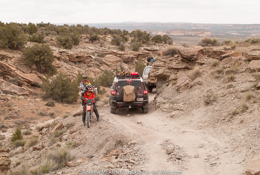
A short distance later we came across some motorcyclists on the trail. At times like this I would analyze the scene as fast as possible and if there was a picture to be had I would tell Sean to stop and I would open the door and stand up to to get the shot. With everyone else still in motion it had to happen fast. We would not encounter another set of motorcyclists the whole day.
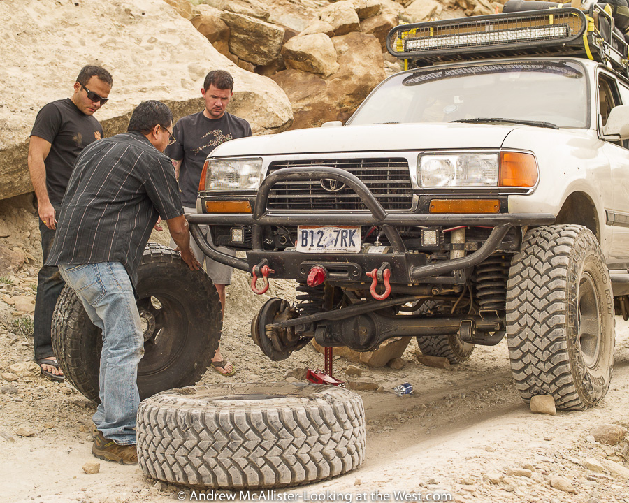
Crossing a boulder field a driver in our group snagged the sharp end of a rock and sliced his tire sidewall. Other drivers jumped in to assist in the wheel change and in short time we were rolling again. Funny how both guys helping are in flip flops. A great thing about traveling in a group like this is that there was plenty of knowledge and more than a few spare parts around and everything was Landcruiser centric.
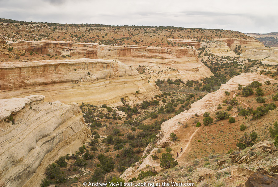
During our pitstop I had time to shoot a few landscape scenes. The Kokopelli Trail is used by used by 4-wheel drive vehicles, motorcycles, mountain bikes and the occasional atv. Everyone we came across was friendly, respectful and staying on the trail. We would meet up with the mountain bikers in the picture above a little later and it turned out that they were attending Cruise Moab too.

After a break for lunch we traveled through many washes of Bitter Creek. This section of the trail had some grazing areas where we came across sheep and cattle. I’d like to travel this section again some time as there are a few good areas for photography. Both Sean and myself considered this trip reconnaissance and location scouting for future trips. Sometime in the future I like to have a truck like the 80 series Landcruiser above. A highly capable off road vehicle with sleeping quarters on the roof, cooking ability, food storage via onboard fridge and most importantly driving and navigation skills to get there and back safely. A sharp bend in the road and how the caravan was spaced out made this shot possible.
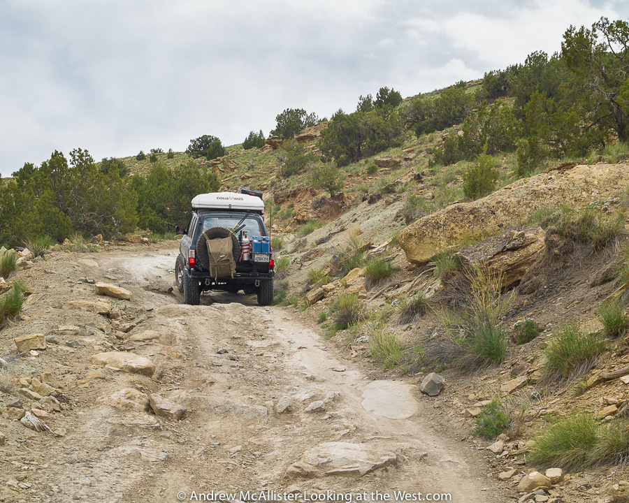
Climbing out of the Bitter Creek area and heading toward Coal Draw. This was an easy section thus I was able to get a sharp picture through the windshield. Most of the way up it was rocky enough that I had to hold on as the cab rocked back and forth. In a group like this you can watch how the vehicle in front of you tracks through the terrain but it’s important to keep in mind how your truck is different. In our case we were pulling a trailer and our line would need to consider how it tracked around obstacles. Other things to consider would be wheelbase and lift (clearance), though all the trucks in our group were similar, it is often not the case.
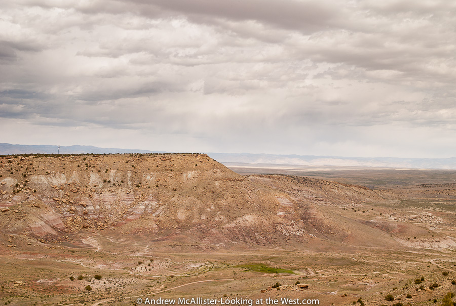
View from the top looking North East toward Colorado. Note the communications tower on the ridge. From this point onward the trail became less and less rugged until finally we reached pavement and enjoyed a few minutes of smooth road. Soon we would turn onto Route 179 and head to our next destination, Cisco Landing for a restroom break and the final leg of trail for day 1.
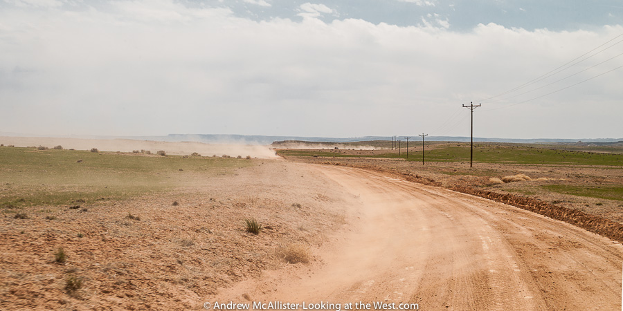 This final stretch of dirt road was nice and smooth. As we increased speed we also increased the distance between vehicles to aid safe driving. As you can see from the picture the combination of loose soil and the wind create a dusty situation. Scientists have found dust originating from Utah covering snow fields in Colorado. That dust is causing the snow to melt faster. Now imagine the amount of dust that is stirred up on the hundred of thousands of dirt roads in the west. Mind boggling…
After a quick stop at the Cisco Landing (pictured above) we headed to Fish Ford, a campground near the Colorado River. As it was early in the season the trees had just started to get their leaves and the overall feel was harsh. Thus not many photos of the camping area. The group spread out around the area and made camp. It was nice to be done with the driving and have some time to walk around. It was a bit windy and I was a little nervous about my first night camping in 20 years to be next to a Cottonwood tree. I set up the borrowed tent as close to the truck as possible thinking it would shield me from wind and falling branches. Pretty silly in retrospect. Naturally it rained that night and I awoke many times thinking I heard animals outside of my tent. The morning revealed no evidence of the large grazing animals that I could swear were just outside my tent all night.
There are many advantages of traveling in a group, safety in numbers, sharing of resources, camaraderie among others. Getting going in the morning, that would be a disadvantage. Once I’m awake I want to get going, make the coffee, pack up and get on with it. With a large group it takes a while just to get everyone up and ready, then there is breakfast and breaking camp. We are talking about a multi hour process here. Not unenjoyable but different than my daily ritual. As a group of strangers camping together for the first time we did a decent job of getting on the trail at a reasonable time.
 A bonus of this trail run was having a dedicated camp chef for the first day and a half who would cook the group a great camp dinner that night and breakfast the next morning. Being that I had been awake the better part of 40 hours and was hanging out with people I just met I did not go into photography mode at dinner time. I did not know if I would even publish a story on the trip. Learning this blogging thing as I go I realize that a group shot or establishing photos of the group would help put things in context. Instead I have the above shot of the cooking and dining area. Far from a great record of the event you will have to trust me that the food and the conversation were a great way to end the day. Many lively conversations continued late into the night, however once the sun set I was ready for sleep and the end of an adventurous day.
 Happy to announce that my image of Thompson Pass looking toward Moab was used as the cover image to a great new book published by The University of Utah Press. The book is Roads in the Wilderness Conflict in Canyon Country by Jedediah S. Rogers who is the winner of the Wallace Stegner Prize in American Environmental or Western History. It can be ordered through Amazon and University of Utah Press. Over the Holidays I had time to read it and found it very enlightening. For example I had no idea how deeply entrenched differing views of the landscape are and how roads play directly into those views. As a new westerner (from Ohio) and avid vehicle based explorer I found Roads in the Wilderness to be welcome change from the trail guides I read on the area. After reading Jedediah Rogers book I have a deeper understanding of how the roads came to be, what they represent to various parties in Southern Utah. I can highly recommend this book to fellow explorers of southern Utah. I am grateful to have one of my images grace the cover of this fine book.
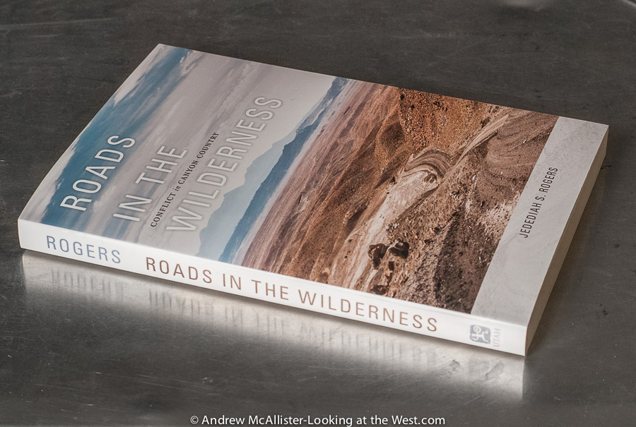 From the back of the book: “A fresh and engaging contribution to environmental history, especially for its interpretation of the Mormon cultural heritage as a driving force for the economic development of the Utah hinterlands. Rogers’s work shows how cultural imperatives arising out of the nineteenth-century settlement period, including memories of the 1879 to 1880 Bluff–San Juan expedition, gave roads their lasting and significant meaning in the minds of many contemporary residents.”
—Frederick H. Swanson, author of Dave Rust: A Life in the Canyons
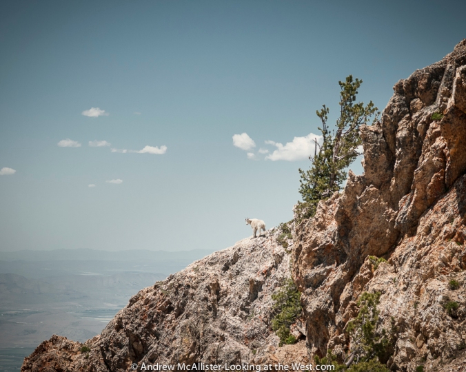
This was a year of looking, learning and contemplating. If I had to choose just one image to represent 2013 it would be this image of a mountain goat on Willard Peak in Northern Utah. I took the photo on a drive to Inspiration Point with a photographer friend who shoots pictures of wildlife. Unlike earlier trips when I looked at animals through binoculars, this time we hiked to the mountain goats and saw them at close range. I look forward to doing more of this in 2014. Technical info: Willard Peak via National Forest Road (starts in Mantua) to Inspiration Point. Accessible in warm months by automobiles with high clearance. The last few turns are at over 9000 feet elevation and exposed. Not for the faint of heart.
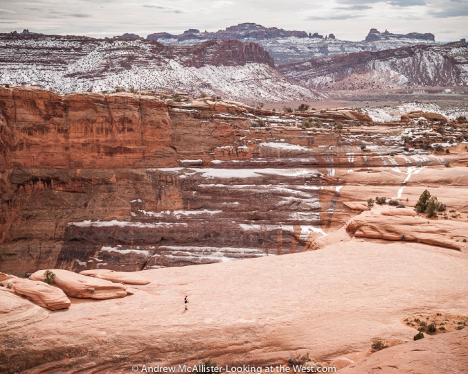
Lone teenager at Delicate Arch in Arches National Park. Any year when you get to visit Moab six times is a good year. The area offers so much to explore and so many photographic possibilities that it boggles the mind. Now that I can go there frequently, I have the luxury of not feeling rushed or compelled to fill the day with a million must-see things.
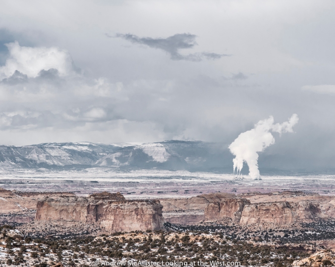
Ghost Rocks viewpoint looking toward the Hunter Power Plant. This photo was taken on a solo winter trip to photograph the area. It was nice to experience Southern Utah at a slower pace and find new locations like this. The quickest way from Moab to SLC is through Price, but a winter storm made travel over Soldier Summit questionable so I took I-70 across the San Rafael Swell and saw a new part of the state.
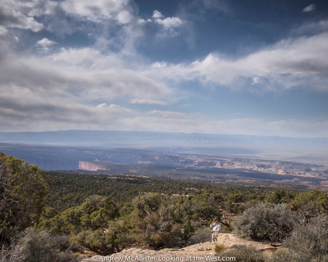 Phone Home on the Range. Last spring I had the opportunity to travel the Kokopelli Trail on a Cruise Moab pre-run. A friend was writing a review of an off-road trailer so I came along to document the run. This great trip gave me access to some amazing country that is not accessible with my stock 4-wd vehicle and I got to meet a group of off-road travel enthusiasts. The view from here to the East Tavaputs Plateau–the ridge line in the distance–is more than 40 miles.
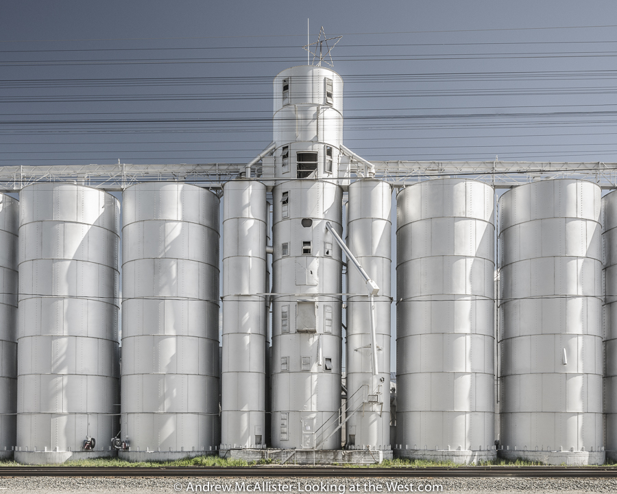
In 2012 I wrote about a grain elevator in Preston, Idaho that burned down and how it seemed to have changed the identity of the town. This year I explored this idea and created a series of images documenting grain silos in small towns within a few hours of Cache Valley, Utah. The image above is from Soda Springs, Idaho. More images from the series can be found on my website.
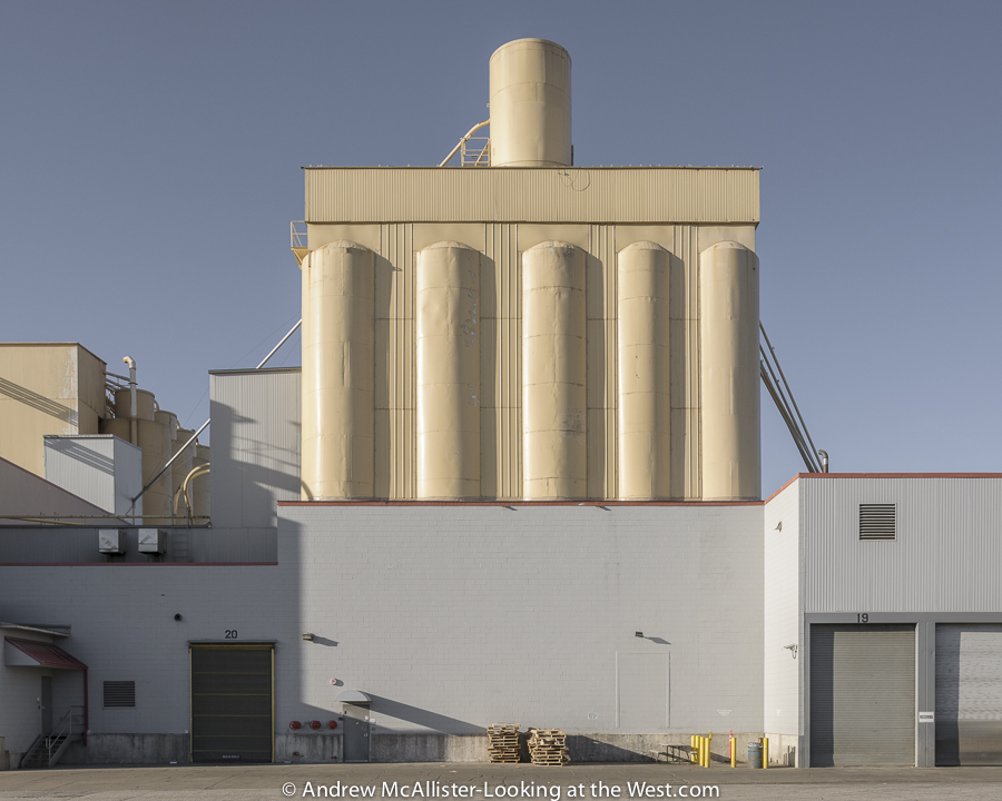 The series on grain elevators led me to industrial areas of towns and other sites like this at American Nutrition in Ogden, Utah. The dramatic light and shadow from the late afternoon sun bring out the structural beauty in this otherwise mundane industrial facility.
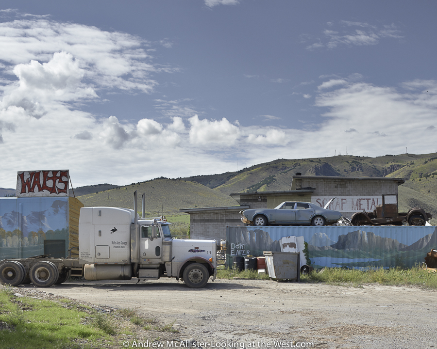
My search for silos took me north to Pocatello, Idaho, where I came across Walts Scrap Metal. It may not speak to everyone, but it interests me because of the play of the flat surfaces depicting western scenes against the actual western landscape. Additionally, the compression of space and the illusions it creates is a kind of puzzle and you have to really look at the photo to pull the different elements apart and try to make sense of the image. Scenes like this make the hours of driving worth it to me.
On a return trip to Utah from Denver I crossed the continental divide via Rocky Mountain National Park’s Trail Ridge Road. I had just completed a Phase One Capture One training event and was delighted to come upon this dramatic scene.
As I mentioned, 2013 involved a lot of learning and looking. When not photographing I spend a lot of time looking at the world via Google Earth. Last year I took advantage the opportunity to look down from an airplane window in Iceland: the location is somewhere between Reykjavik and Akureyri.Shelf road leading out of Spring Canyon. From my sixth and final Moab trip of 2013. I hope you enjoyed this short review of my 2013 photographs and if you have a similar post about your past year’s adventures please share a link in the comments section.
Happy travels and pleasant photography for the coming year!
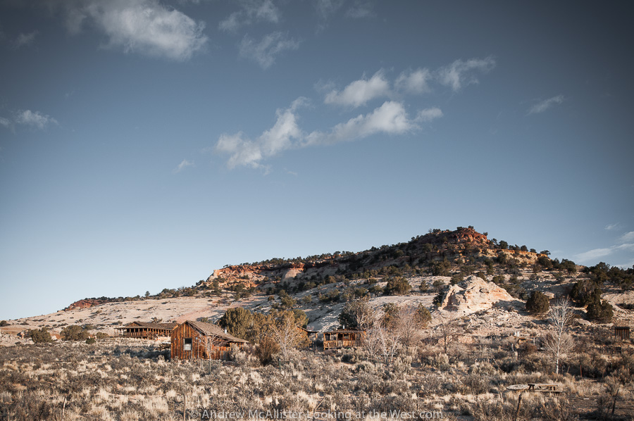
On your way to the Needles District of Canyonlands National Park in Southern Utah on the top of the first hill you will pass by a small ghost town with a locked gate and a sign over the entrance that says Maries Place. Most people will hardly notice and just pass by this desolate and nondescript grouping of buildings without ever knowing the colorful story of what happened here. Above: the Inner Portal of the Home of Truth. The story of these buildings can be found in the wikipedia entry “Home of Truth, Utah”. 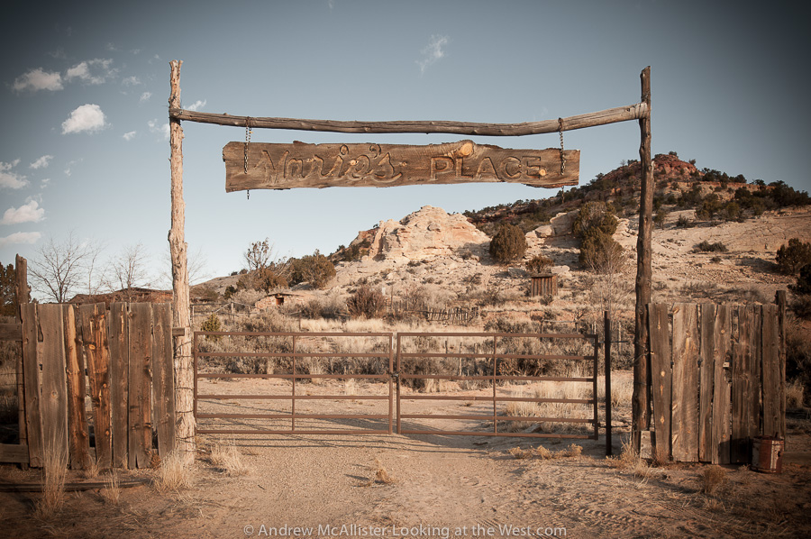 Above: The locked gate. Respect private property and photograph the Home of Truth from the road. Hopefully in the future it will be open for visitors to explore.
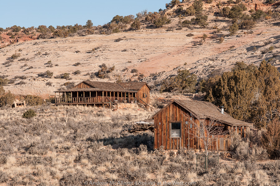
Above: Abandoned buildings at the Home of Truth. I would love to someday tour the facility and see the view from that wrap around porch.
 Above: The largest building at the Home of Truth photographed in early morning light from North Flats Road. The area around the Home of Truth is great for scenic driving with many striped rock outcroppings and the occasional corral.The better part of an hour south of Moab it is usually passed by as visitors are on the way to the famous newspaper rock petroglyph site.
 Not all of Southern Utah is Red Rock. The ranch exit of Floy (near Crescent Junction) has a great collection of strange grey lumps that may make you think you are on another planet. I last visited in early February and it was much to muddy to go exploring off the road. The time before it was around 100˚ with no shade. This landscape at the base of the Book Cliff does not fail to inspire.
Above: When driving Utah 152 watch your speed. Because the road is empty 99.99% time, it’s tempting to drive in the middle or left side of the road to avoid potholes and rough section. Beware though that the road does have blind areas and would be terrible to have a head on collision in such a remote place (or anywhere). On a technical note these images were shot using Nikon’s 24mm PC-E lens. I’m finding it to be a great lens for the landscapes I’m photographing. Any thoughts on the lens flair in the right corner. Some people like it, I usually get rid of it.
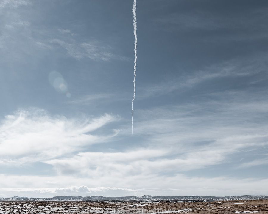 Above: Contrail in the Southern Utah sky.
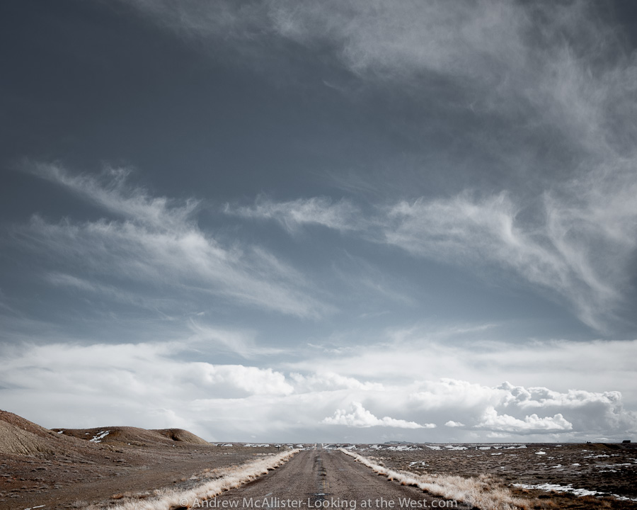 Above: Open Road at the Floy ranch exit near Crescent Junction. Note the lack of shoulder and no fence so watch out for the wildlife.
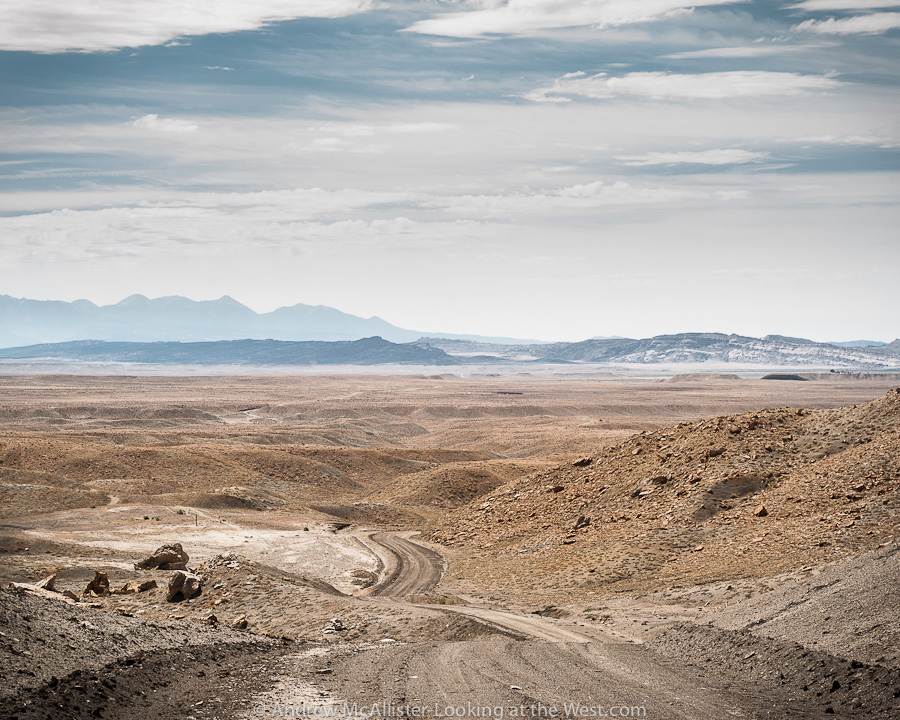
Above: Thompson Pass looking toward Moab. If you look close you can see Crescent Junction and State Highway 191. This is from the base of the Book Cliffs looking South. The road is a nice little side trip if barren landscape, boulders and the occasional Antelope is your thing (it’s mine). I read that somewhere along the Book Cliffs a Tar Sand extraction operation is starting up. Mixed feeling on that. Anyone know the exact location? I’d like to do a before and after shot if it’s lot to late.
 Above: Almost a ghost town, Thompson Springs, Utah. I have spent a lot of time looking at this humble little house making up little stories about what happened here. This little house from another time with it’s yard clearly defined from the larger surrounding. A power pole that marks the location like it was a road side casualty. Not generally a fan of the photo cliche’ of dilapidated buildings or “Ruin Porn” I usually pass these structures by and leave them to other photographers. Something about this one…
 Above: Abandoned structures in Thompson Springs. Would love to find an image of what was once here. Building on the left looks like it was used for some sort of agricultural storage. Look closely at the space between the buildings. A sealed (at one time) passage. The structure on the right looks like two buildings sharing a common front. The left one had a door and a window, the right one a door and two windows. The doors are tricky. Was the original door between the windows and then at some later time when the two fronts became one the door moved to the center and old door locations filled in? I’m probably to respectful for my own good as a I honor privet property and only shoot from the road. Next time I’m down there I’ll have to find someone who knows.
 Above: Almost ghost town. Classic abandoned house next to the Desert Moon Hotel (actually a small trailer park for temporary workers that live out of campers parked there. And the Hotel is for sale if anyone is interested.
 Above: Detail of the doorway mystery.
 Above: Shadow portrait at the Thompson Springs Diner. The diner is pretty boring both inside and out. I thought this was the best photo for the location. Thompson Springs has a few other buildings including a Hotel with about 20 rooms (all with the doors open and full of trash and graffiti) The train depot (abandoned) and a few occupied residences. Someday I’ll return and photograph them as I’d like to meet the residents of this almost ghost town. I’m sure there are some interesting folks there.
Below: Backside of my favorite house in Thompson Springs.

 Crescent Flat just north of I-70, August 2012. This primitive detour made me think of the hazards of early automotive travel. By the way it was really hot.
 Train moving uranium tailings from Moab to Crescent Flat.
 My past eight posts have been about Southern Utah and my trips to Canyonlands and Arches National Parks. The landscape is so dramatic there that it has been a struggle to get back in a Northern Utah frame of mind for the blog. However slow posting does not mean I have not been out looking at the west and exploring. Shortly before leaving for Moab I met up again with the Utah Xterra Owners Club for an afterwork outing on Skyline Drive above Bountiful. When the outing was first being discussed I had misinterpreted where we were meeting and discovered that there are many skyline drives in Utah. Our trip that evening was cut short due to a gate being locked but we did find a few nice spots to pull over and enjoy the sunset. Though the view is nice the overall experience is a bit squalid. The area was crawling with people most of whom were on ATV’s and dirt bikes and many more camping on the side of the road. Literally on the side of the road. Like not even ten feet from the road. Needless to say this area is not on my list of places to camp. However the view is worth it and I saw more than a few 2WD cars up there so give it a look if you are in the area. The road starts near the big “B” above Bountiful. When the road is fully open you can drive all the way up to Bountiful Peak (elevation 9259 ft.)
 The photo above is from another Skyline Drive. This road is in the Caribou National Forest just over the Idaho border. Given the location you will see more cattle than people and the area was ATV free during our visit. I would recommend starting from the Cache Valley side vs. the I-15 side as it’s a bit tricky to find the road on the west side. From the small town of Weston head west toward Weston Canyon. The road to Dry Canyon Campground is the road you want to start the drive. It’s a decent gravel road and not challenging. The views are not spectacular in a postcard kind of way but subtle, relaxed and quite. When I came across this small herd of cattle tucked away along this creek I had to stop and take a picture. It really says “the west” to me.
