No Town Utah: Floy revisited

20130209_Floy Utah_014
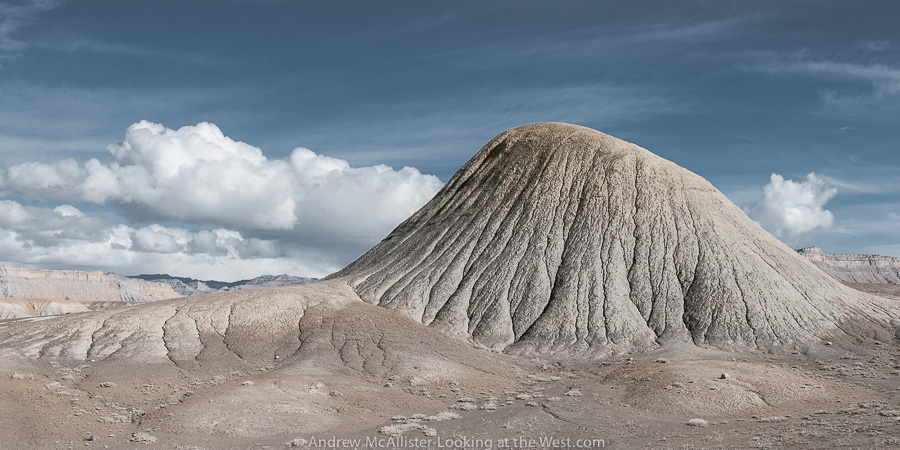
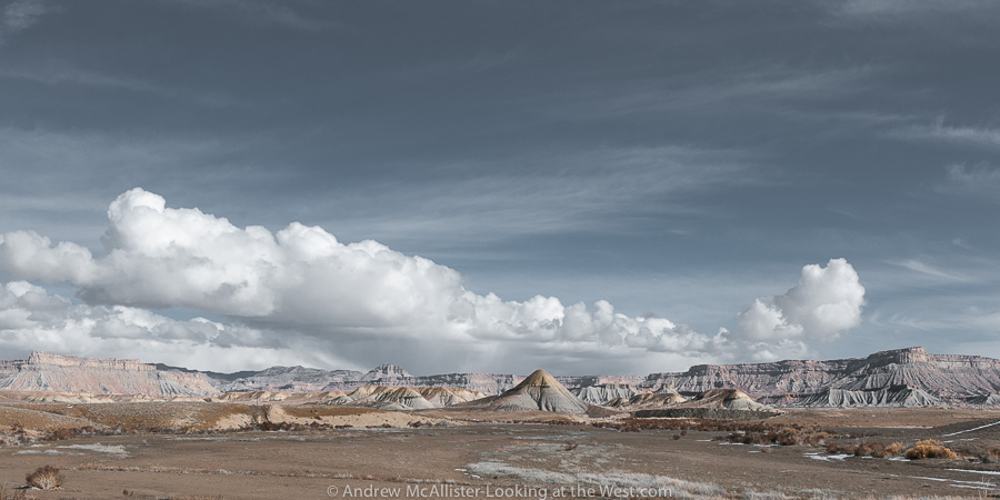
Not all of Southern Utah is Red Rock. The ranch exit of Floy (near Crescent Junction) has a great collection of strange grey lumps that may make you think you are on another planet. I last visited in early February and it was much to muddy to go exploring off the road. The time before it was around 100˚ with no shade. This landscape at the base of the Book Cliff does not fail to inspire.

20130209_Floy Utah_011

20130209_Floy Utah_029

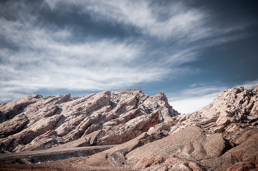
Above: When driving Utah 152 watch your speed. Because the road is empty 99.99% time, it’s tempting to drive in the middle or left side of the road to avoid potholes and rough section. Beware though that the road does have blind areas and would be terrible to have a head on collision in such a remote place (or anywhere). On a technical note these images were shot using Nikon’s 24mm PC-E lens. I’m finding it to be a great lens for the landscapes I’m photographing. Any thoughts on the lens flair in the right corner. Some people like it, I usually get rid of it.

20130209_Floy Utah_008
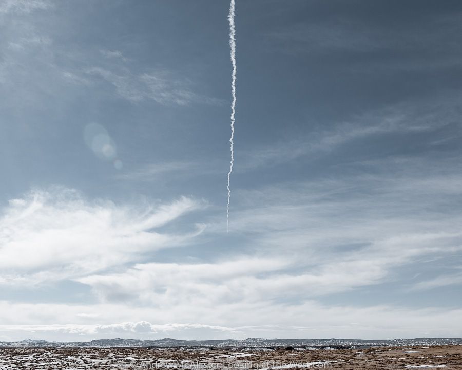
Above: Contrail in the Southern Utah sky.

20130209_Floy Utah_007
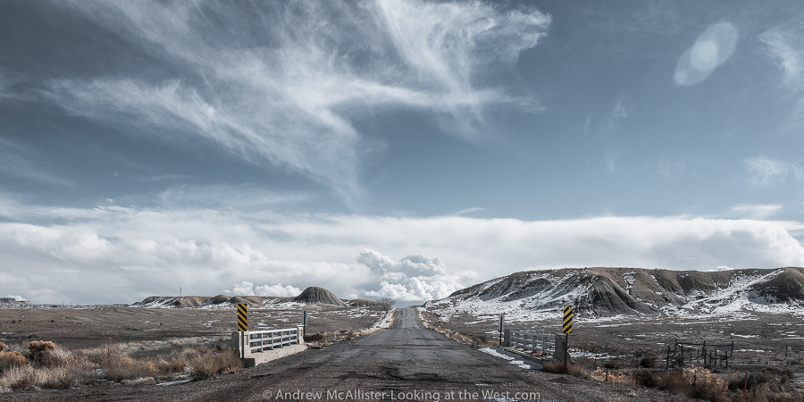
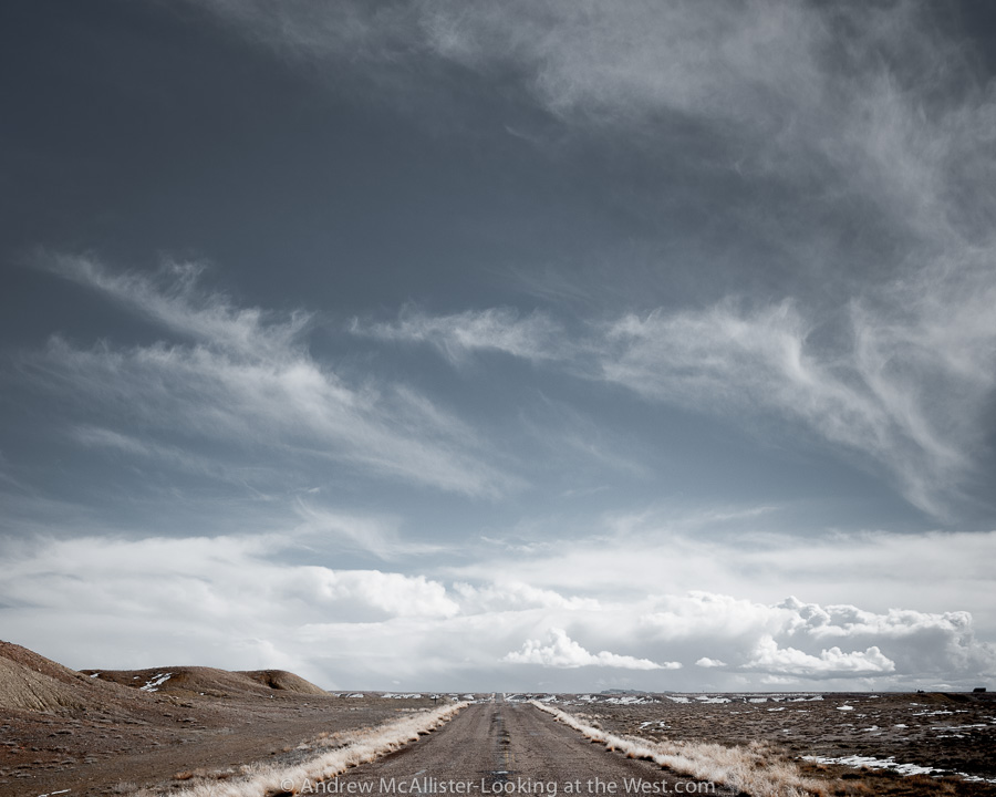
Above: Open Road at the Floy ranch exit near Crescent Junction. Note the lack of shoulder and no fence so watch out for the wildlife.

Southern Utah: San Rafael Reef


San Rafael Reef in Southern UtahAbove: I-70 road cut at the San Rafael Reef in Southern Utah. To avoid a snow storm on Soldier Summit I decided to take I-70 for my return route from Moab last month. What a good decision it was. The San Rafael Reef is visible from my usual route (Utah 191 from Price) but I had never been this close. If you are traveling I-70 through this area plan extra time to stop at all of the scenic overlooks, they are well worth it. Taking this route greatly expanded my desire to explore Southern Utah. Expect more information and photos from this amazing part of the state.

San Rafael Reef in Southern Utah
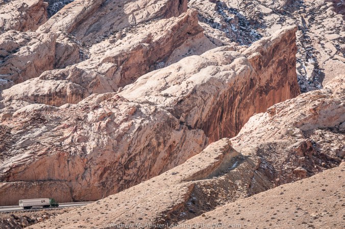
Above: Detail of the road cut at the San Rafael Reef. Didactics at the rest area explain the massive project to widen a slot canyon into the modern highway we travel today.

San Rafael Reef in Southern Utah

Above: I-70 Rest Area at the base of the San Rafael Reef. Photographers would be crazy not to stop.Book Cliffs from the San Rafael Reef in Southern Utah

Above: Looking toward the Book Cliffs from the San Rafael Reef.

How many of you have been to this part of Southern Utah?

Southern Utah is not all red rock

Driving the desert of Southern UtahAbove: Thompson Pass looking toward Moab. If you look close you can see Crescent Junction and State Highway 191. This is from the base of the Book Cliffs looking South. The road is a nice little side trip if barren landscape, boulders and the occasional Antelope is your thing (it’s mine). I read that somewhere along the Book Cliffs a Tar Sand extraction operation is starting up. Mixed feeling on that. Anyone know the exact location? I’d like to do a before and after shot if it’s lot to late.

Almost Ghost Town: Thompson Springs, Utah

Above: Almost a ghost town, Thompson Springs, Utah. I have spent a lot of time looking at this humble little house making up little stories about what happened here. This little house from another time with it’s yard clearly defined from the larger surrounding. A power pole that marks the location like it was a road side casualty. Not generally a fan of the photo cliche’ of dilapidated buildings or “Ruin Porn” I usually pass these structures by and leave them to other photographers. Something about this one…

Above: Abandoned structures in Thompson Springs. Would love to find an image of what was once here. Building on the left looks like it was used for some sort of agricultural storage. Look closely at the space between the buildings. A sealed (at one time) passage. The structure on the right looks like two buildings sharing a common front. The left one had a door and a window, the right one a door and two windows. The doors are tricky. Was the original door between the windows and then at some later time when the two fronts became one the door moved to the center and old door locations filled in? I’m probably to respectful for my own good as a I honor privet property and only shoot from the road. Next time I’m down there I’ll have to find someone who knows.

Above: Almost ghost town. Classic abandoned house next to the Desert Moon Hotel (actually a small trailer park for temporary workers that live out of campers parked there. And the Hotel is for sale if anyone is interested.

Above: Detail of the doorway mystery.

Above: Shadow portrait at the Thompson Springs Diner. The diner is pretty boring both inside and out. I thought this was the best photo for the location. Thompson Springs has a few other buildings including a Hotel with about 20 rooms (all with the doors open and full of trash and graffiti) The train depot (abandoned) and a few occupied residences. Someday I’ll return and photograph them as I’d like to meet the residents of this almost ghost town. I’m sure there are some interesting folks there.

Below: Backside of my favorite house in Thompson Springs.


No Town Utah: Floy

In Southern Utah on the way to Moab from SLC there is a stretch of lonely lumps that the highway passes. Interesting little piles of earth away from the Book Cliffs out in the middle of nowhere. Usually one passes them by at a high rate of speed for they are on I-70 between Green River and Crescent Junction and if you are going to Moab, well you are almost there, why stop. Same can be said of the return north from Moab, we just started the drive and have hours to go, why stop. Recently I had the opportunity to make the drive to Moab by myself and managed to make the 4 hour trip last 8 hours due to lots of stopping and looking around. Well worth it if you are so inclined. On a map the area pictured is called Floy. It’s not a small town or a ghost town it is a “no town” sometimes known as a Ranch Exit (no services).

The classic cliché photograph of the open road is one I’ll never tire of. Should you take the ranch exit at Floy this is the road you will be traveling on as you go west to Green River. After a few miles of rough road you will wonder why you are taking slow a desolate alternate route when a much smoother and nice road is just a mile to the South. For starters you can stop just about anywhere. The time I spent out there the only other vehicles I saw were a pair of adventure motorcyclist. Stop and look around, take pictures, think about stuff, look for animals, whatever. When these pictures were taken it was pushing 100 degrees and the place was like an oven. Sunscreen, wide brim hat and long sleeve linen shirt are all recommended. In the 30 minutes or so that I was out in the sun my aluminum tripod legs and camera became hot to the touch and I downed a liter of water. This two lane road with minimal upkeep reminded me of being a youth in the 1970’s and traveling great distances in a VW Bug with the windows down, arm hanging out and hot as heck. Traveling in the air-conditioned and window tinted vehicles of today sometimes feels like cheating. I can imagine what it was like traveling these roads in an old Packard or other late 40’s car would have been like. I have nothing against the modern highways but it is the roads less traveled (paved or dirt) that are the most enjoyable for me.

Exploring high places: Logan Peak Summer 2012

After a year living in Logan I had the opportunity to drive up to Logan Peak (elevation 9710) this past June with my friend Carston and wow, what a drive it is. As with most drives in the Wasatch-Cache National Forest all but a few sections can be handled with a normal all wheel drive car and competent driver. In this case we passed a Honda Element (not high clearance vehicle) a mile or so from the top and it really was not until the last 100 yard that I had to put the Xterra into 4-wheel low. If you live in the area you should give it a visit sometime. The fastest route is via Logan Canyon and Right Hand Fork. From there go up Crowley Canyon (Forest Route 047) at the junction go west on 052. The next major turn is at White Bedground Camp with the way to Logan Peak well marked (Forest Route 168). This stretch of road goes through a really nice and well developed Aspen grove, has some fun switchbacks and a nice climb at the end where there is a parking area. At this point you will stay left on a nicely graded section of road, not the steep and rocky side trail to the right. The trail stays relatively flat until the last turn onto Forest Route 042. A mile or so later you will be there. This last section I would not attempt in a normal street clearance vehicle as there is a short rocky section that may stop you and the last section before the radio tower that will stop you for sure, plus it would be a pain in the ass to back out. The roads in the area close November 15 or earlier depending on winter weather.

Above: View from the top looking East. The road is Forest Route 042. As a side note the day we drove up there was a race and the road was packed with runners and mountain bikers.

Above: Last bits of snow hanging on.

Above: Looking North West from Logan Peak June 2012. These photos give an idea of the place and I would consider them location scout shots. The views would really be stunning on a cool fall morning at first light. I guess that means I have a return trip in the coming months. Yeah! One final note, access to Logan Peak via Providence Canyon was closed as of June 2012 to vehicles (Impassable). If you plan on visiting via that route check with the ranger station to confirm that Forest Route 090 is open.

Exploring high places: Willard Peak

Above: Willard Peak from Willard Basin. About an hour drive from the start of the trail, almost to Inspiration Point. I first drove this on a whim last summer and had no idea how cool the view from the top was. I’m so happy to live near such amazing places.

Above: Almost to the top, looking down toward I-15 and the northern end of the Great Salt Lake. Smoke from wildfires have made theses views impossible this August.

Above: From Inspiration Point looking down toward Ogden. Amazing view with no hiking required.

Above: Looking at Mountain Goats on Willard Peak.


Back to Northern Utah

My past eight posts have been about Southern Utah and my trips to Canyonlands and Arches National Parks. The landscape is so dramatic there that it has been a struggle to get back in a Northern Utah frame of mind for the blog. However slow posting does not mean I have not been out looking at the west and exploring. Shortly before leaving for Moab I met up again with the Utah Xterra Owners Club for an afterwork outing on Skyline Drive above Bountiful. When the outing was first being discussed I had misinterpreted where we were meeting and discovered that there are many skyline drives in Utah. Our trip that evening was cut short due to a gate being locked but we did find a few nice spots to pull over and enjoy the sunset. Though the view is nice the overall experience is a bit squalid. The area was crawling with people most of whom were on ATV’s and dirt bikes and many more camping on the side of the road. Literally on the side of the road. Like not even ten feet from the road. Needless to say this area is not on my list of places to camp. However the view is worth it and I saw more than a few 2WD cars up there so give it a look if you are in the area. The road starts near the big “B” above Bountiful. When the road is fully open you can drive all the way up to Bountiful Peak (elevation 9259 ft.)

The photo above is from another Skyline Drive. This road is in the Caribou National Forest just over the Idaho border. Given the location you will see more cattle than people and the area was ATV free during our visit. I would recommend starting from the Cache Valley side vs. the I-15 side as it’s a bit tricky to find the road on the west side. From the small town of Weston head west toward Weston Canyon. The road to Dry Canyon Campground is the road you want to start the drive. It’s a decent gravel road and not challenging. The views are not spectacular in a postcard kind of way but subtle, relaxed and quite. When I came across this small herd of cattle tucked away along this creek I had to stop and take a picture. It really says “the west” to me.

Exploring Canyonlands: Potash Road and the Shafer Switchbacks

The Shafer Switchbacks have been on my to do list since I caught the off-road, 4-wheeling, Overlanding bug a few years ago and on this last trip to Moab I had the opportunity drive them. This route was on my mind both from reading the Guide to Backroads around Moab and from viewing posts from the blog New Mexico Backroads a few weeks before my trip. Needless to say I was psyched! Above: Evaporation ponds and red rock. Below: Really red rock! If you look close in the center of the picture you can see a few ladders that are part of a ropes course.

Below: Looking up at Dead Horse Point State Park from Potash Road. Classic western landscape.

Below: Thelma and Louise Point looking at the Colorado River.

Below: Looking North from Thelma and Louise Point. The rock wall in the image produces amazing echo with 4 or more distinct slap backs. A very cool stereo experience. Give it a yodel and see for yourself. A few miles later we would enter Canyonlands National Park and be greeted with a small but very rocky section of road that required low range gearing and all of the driver’s attention (thus no photos of this section). My stock Xterra handled the rocky section beautifully. (edit summer 2014 the road has been improved and is now very smooth. Conditions can change with one good rainstorm, if in doubt contact the National Park.

Below: Shafer Switchbacks. Notice the very small people in the top right corner. Next time I’ll have to remember to stop at a few points and get some pictures. For my first time up I just kept my hands on the wheel and eyes on the road. The switchbacks and the climb were not that bad however I was not ready for the long drive on the narrow shelf road once we were at the top. That section was a bit nerve racking.

Below: Looking down on a group of cyclists that were starting multi day trek on the White Rim Trail. The road was first used as a cattle trail and later as a road for mining trucks. The thought of driving trucks on that road makes me think of the movie The Wages of Fear.