
Location scouting for an upcoming photo shoot brought me to the north end if the Great Salt Lake. Pretty desolate looking and just what I had in mind. Have any of the blog followers travelled this route to the Lucin sun tunnels?
Location scouting for an upcoming photo shoot brought me to the north end if the Great Salt Lake. Pretty desolate looking and just what I had in mind. Have any of the blog followers travelled this route to the Lucin sun tunnels?
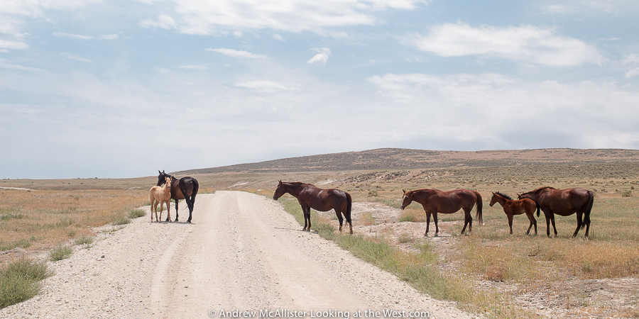
Once, when heading out to see Robert Smithson’s Spiral Jetty we came upon this family of horses grazing near the road. The landscape of Promontory is austere and so different from the I-15 area just 40 minutes away. Locals will tell you that the road was much rougher in years past and had a few points where 4WD was required. In my many trips out there I have seen Audi Coups, passenger vans and even a Kenworth. Follow the signs and drive sensibly and you will make it.
It’s been a busy month or so but the lack of posts do not mean I have not been out looking at the west. I have some new images ready that include a trip on the Kokopelli Trail (including Top of the World and Rose garden Hill) during Cruise Moab, lots of looking at grain elevators around Cache Valley and some other nice scenery.
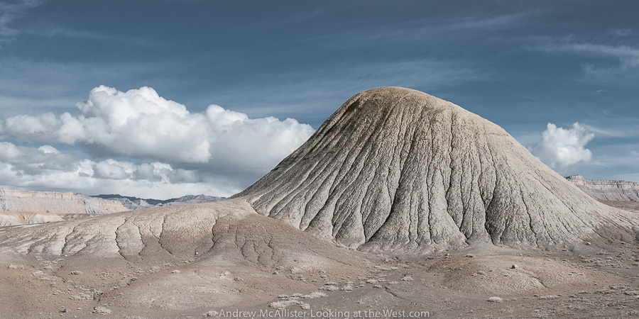 Not all of Southern Utah is Red Rock. The ranch exit of Floy (near Crescent Junction) has a great collection of strange grey lumps that may make you think you are on another planet. I last visited in early February and it was much to muddy to go exploring off the road. The time before it was around 100˚ with no shade. This landscape at the base of the Book Cliff does not fail to inspire.
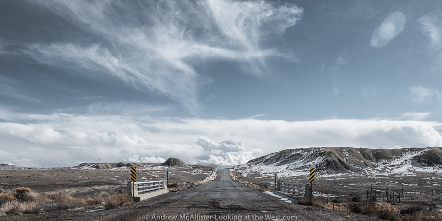
Above: When driving Utah 152 watch your speed. Because the road is empty 99.99% time, it’s tempting to drive in the middle or left side of the road to avoid potholes and rough section. Beware though that the road does have blind areas and would be terrible to have a head on collision in such a remote place (or anywhere). On a technical note these images were shot using Nikon’s 24mm PC-E lens. I’m finding it to be a great lens for the landscapes I’m photographing. Any thoughts on the lens flair in the right corner. Some people like it, I usually get rid of it.
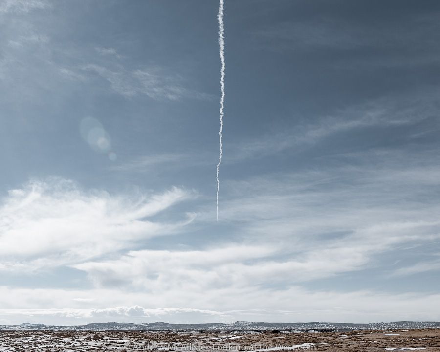 Above: Contrail in the Southern Utah sky.
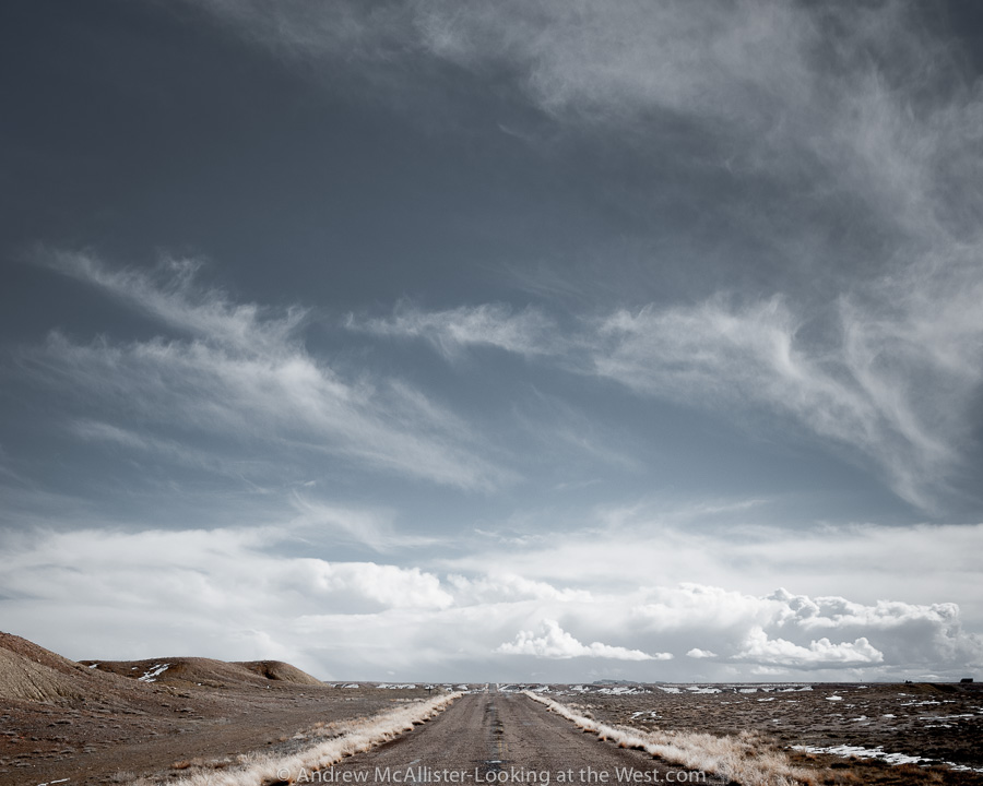 Above: Open Road at the Floy ranch exit near Crescent Junction. Note the lack of shoulder and no fence so watch out for the wildlife.
 Who knew red rock country could look silver and blue? A few images from my first trip to Moab this year (February 2013). All three were taken along Utah Scenic Route 128. It starts near the ghost-town of Cisco and follows the Colorado River into Moab via Professor Valley. The image above is available through Glow Artworks who I starting working with earlier this year.
 It would not be Utah if the landscape did not have some evidence of the gas and oil industry. The facility above is part of a pipeline that runs through the area.
 Lastly a view into Professor Valley from Utah Scenic Route 128. Close to the center is Fisher Towers, an area not known to look blue. FWIW all 3 images were shot with the spectacular Zeiss 100mm Makro-Planar lens.

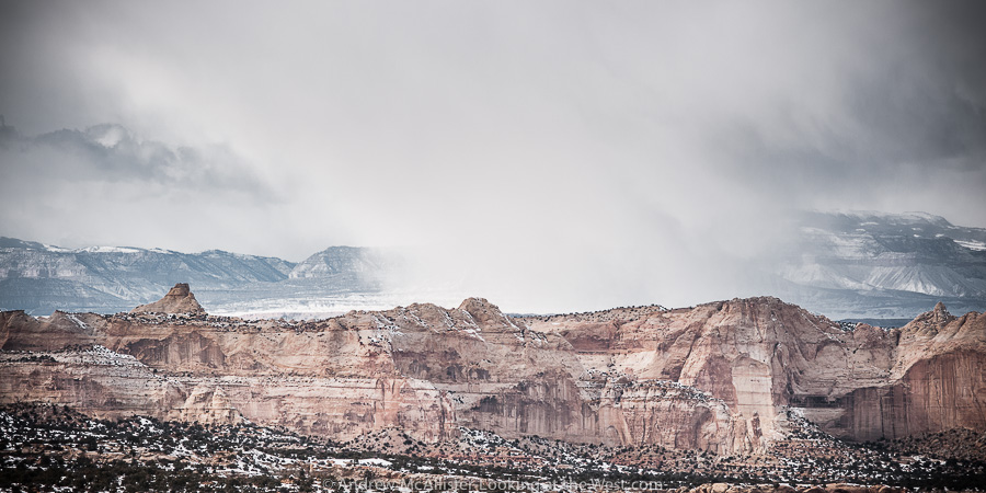
Above: Huntington Power Plant from Ghost Rocks Viewpoint along I-70 in Southern Utah.
Updated (3/16/13) from Wikipedia “The highway then ascends Ghost Rock Summit, the highest point for I-70 inside the swell. At the summit is another view area overlooking the Little Grand Canyon of the San Rafael River.The summit is named for unusual rock formations nearby. The Ghost Rocks themselves are at 7,405 feet (2,257 m), although the freeway is slightly lower.” Read the whole article on building I-70 through Utah here.
Above: Cloudburst above Castle Valley Utah.
Top images from 2012 and a little info behind their selection.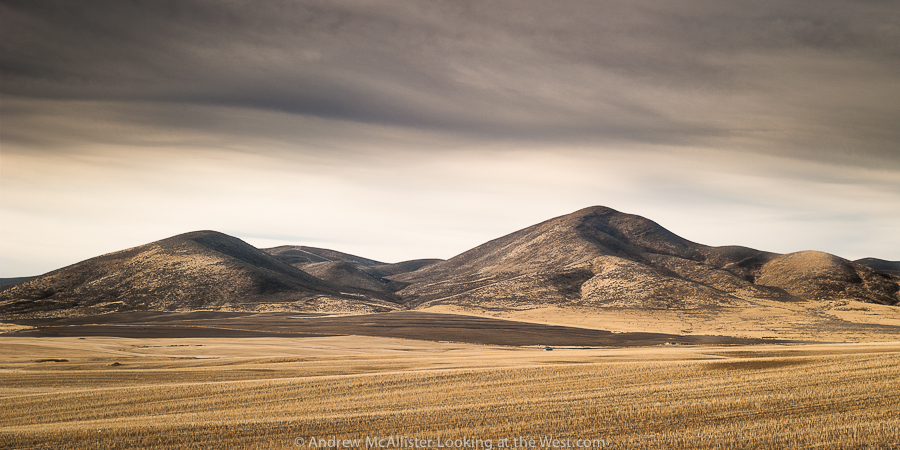 Above: Whites Valley in Northern Utah. An introduction to a different western landscape and the beginning of my exploration Northern Utah and Idaho. Looking forward to exploring the gem state in 2013 and have 4 trips planned already.
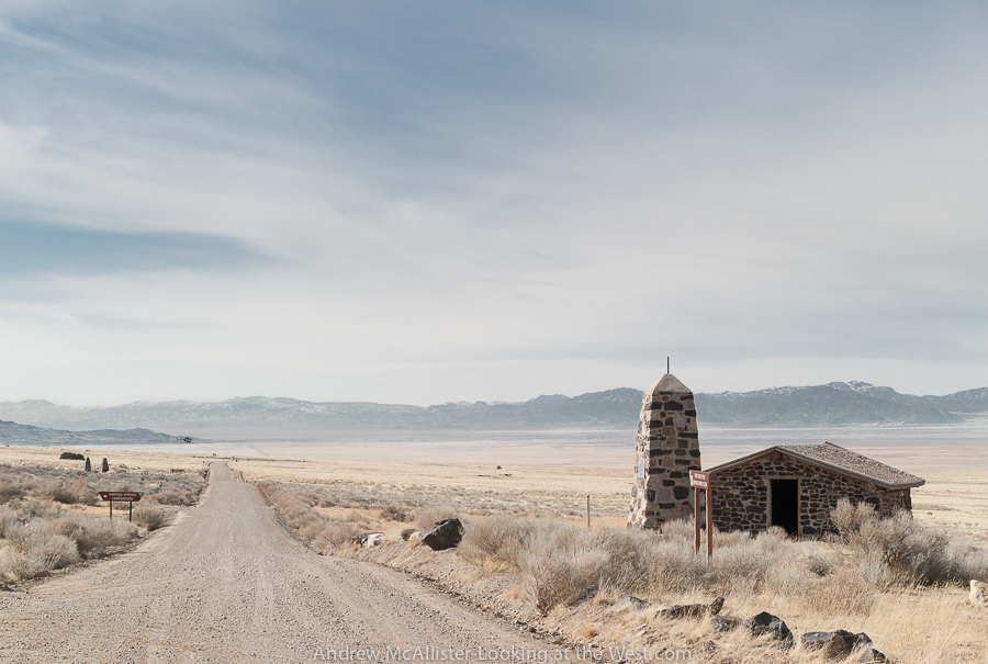
Above: Simpson Springs Station on the Pony Express Trail in the West Desert of Utah, from a journey I’ll do again this year with the UXOC. This is a beautiful and remote area that I’d love to explore more, maybe pulling a camper from Moby 1.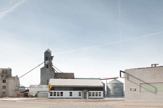
Above: Preston, Idaho on a sunny Sunday morning January 2012 and the start of a project looking at small western towns and structures that define place. In this case it was the grain elevator that defined entering Preston and unfortunately it was destroyed by fire a month later.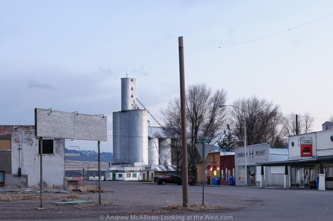
Above: Weston, Idaho and another grain elevator. This one looks particularly church like. I revisited Weston in December and the sign and pole have been removed. Time moves on even in small towns.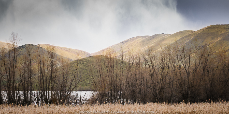
Above: Mantua, Utah spring 2012. At the time I took this the space reminded me of Iceland. Looking at it now it is nothing like Iceland, trees for starters. Maybe it was the really green treeless hills and the rain snow mix of weather. I’ll settle for exotic looking and not what you expect for a Utah landscape. FWIW locals pronounce Mantua as “Man Away”.
Above: Near Cutler Reservoir early spring 2012. Jetsons-looking power pole in a barren landscape carved by man for irrigation.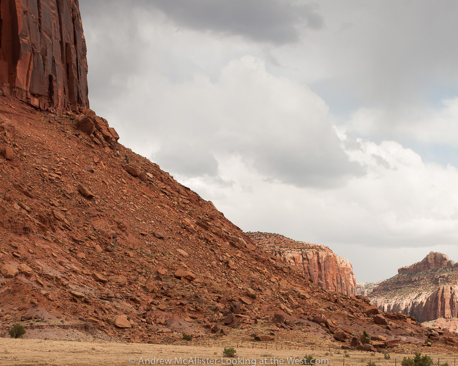
Above: Near the Needles District of Canyonlands National Park. Trying to get a feel for how massive these formations are (look at the fence at the base).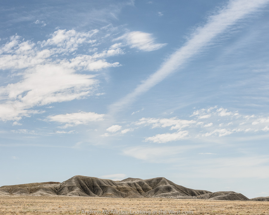
Above: Ranch Exit at Floy, Utah. Grey lumps in the barren landscape just north of I-70. Composed in a way that excludes the book cliffs and any of the red rock that southern Utah is famous for. People have commented on the texture of the grey earth looking elephant like.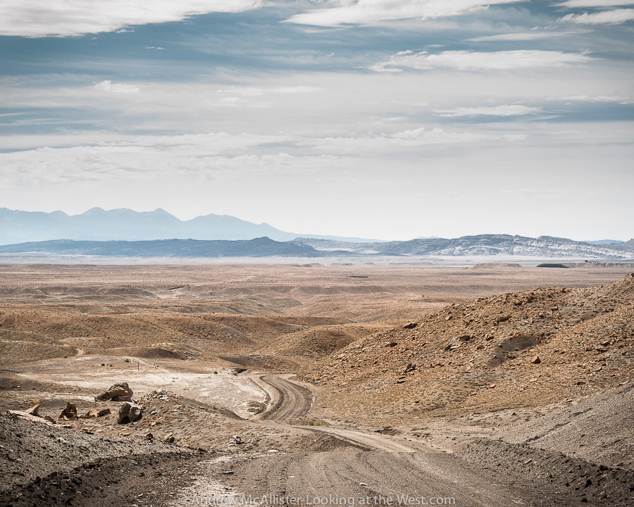
Above: from the base of the Book Cliffs looking toward Moab, Klondike Bluff and the Manti La Sal Mountains. From a solo trip to Moab in early August 2012.
Above: Onion Creek Road near Moab. Look for more images from this area in the coming year. Lots to explore and photograph. This was taken on my first trip on the road and as it was getting dark I made my way back to the main road. Not being familiar with the road, alone, and without additional illumination on the Xterra. Why risk driving off the road in the dark?  Above: Open road on Skyline Drive near Weston Canyon in Caribou National Forest. From a day of photographing open roads near the Utah-Idaho border in late October and my last trip on this road before it was closed for the season. As I was taking these images I came across three moose; a nice way to end a day of solitary photography. Work kept me busy the rest of the year and so this is where my 2012 season of photography ended. Looking forward to what 2013 will bring.
Thanks to everyone who liked a post, made a comment, nominated me for an award or became a follower of Looking at the West.
 Crescent Flat just north of I-70, August 2012. This primitive detour made me think of the hazards of early automotive travel. By the way it was really hot.
 Train moving uranium tailings from Moab to Crescent Flat.
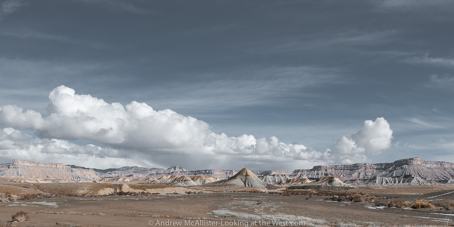
 My current favorite area Southern Utah. Christmas Ridge near Crescent Junction.
In Southern Utah on the way to Moab from SLC there is a stretch of lonely lumps that the highway passes. Interesting little piles of earth away from the Book Cliffs out in the middle of nowhere. Usually one passes them by at a high rate of speed for they are on I-70 between Green River and Crescent Junction and if you are going to Moab, well you are almost there, why stop. Same can be said of the return north from Moab, we just started the drive and have hours to go, why stop. Recently I had the opportunity to make the drive to Moab by myself and managed to make the 4 hour trip last 8 hours due to lots of stopping and looking around. Well worth it if you are so inclined. On a map the area pictured is called Floy. It’s not a small town or a ghost town it is a “no town” sometimes known as a Ranch Exit (no services).

The classic cliché photograph of the open road is one I’ll never tire of. Should you take the ranch exit at Floy this is the road you will be traveling on as you go west to Green River. After a few miles of rough road you will wonder why you are taking slow a desolate alternate route when a much smoother and nice road is just a mile to the South. For starters you can stop just about anywhere. The time I spent out there the only other vehicles I saw were a pair of adventure motorcyclist. Stop and look around, take pictures, think about stuff, look for animals, whatever. When these pictures were taken it was pushing 100 degrees and the place was like an oven. Sunscreen, wide brim hat and long sleeve linen shirt are all recommended. In the 30 minutes or so that I was out in the sun my aluminum tripod legs and camera became hot to the touch and I downed a liter of water. This two lane road with minimal upkeep reminded me of being a youth in the 1970’s and traveling great distances in a VW Bug with the windows down, arm hanging out and hot as heck. Traveling in the air-conditioned and window tinted vehicles of today sometimes feels like cheating. I can imagine what it was like traveling these roads in an old Packard or other late 40’s car would have been like. I have nothing against the modern highways but it is the roads less traveled (paved or dirt) that are the most enjoyable for me.
